Kashafrud river - رودخانه کشف رود
اینجا درباره رودخانه کشفرود ایران مینویسمKashafrud river - رودخانه کشف رود
اینجا درباره رودخانه کشفرود ایران مینویسمدرباره من
 از اونهام که می گم آدم بایست حرف خودشو بزنه، اما یاد گرفتم که هر حرفی رو تو جاش بزنم، اینجا، هرچی می خوام رو می گم
ادامه...
از اونهام که می گم آدم بایست حرف خودشو بزنه، اما یاد گرفتم که هر حرفی رو تو جاش بزنم، اینجا، هرچی می خوام رو می گم
ادامه...
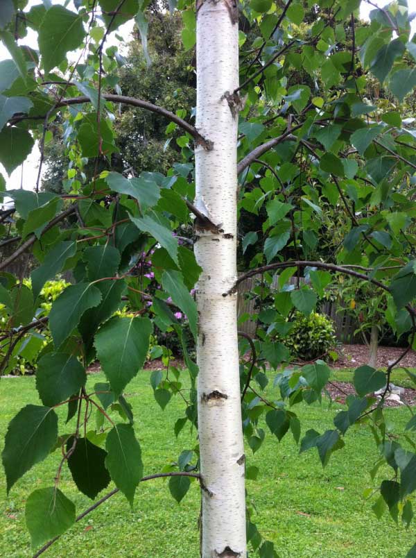
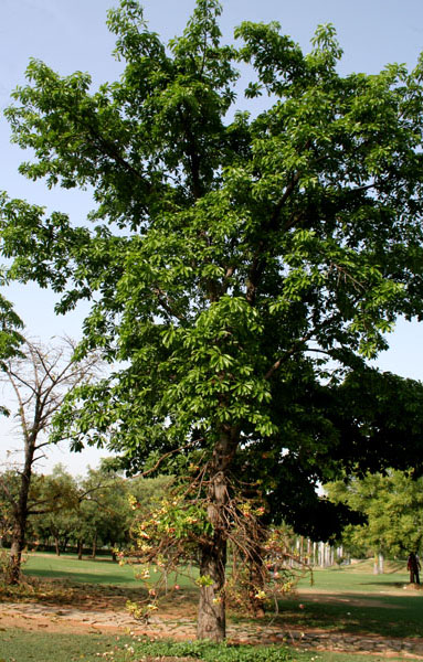
جنگل توسکای توس
«توس سرسبز» که با جنگل انبوه هیرکانی و توسکا پوشیده شده، در شمال آرامگاه فردوسی از غرب به شرق و در امتداد کشفرود امتداد یافت.
شهری که در امتداد این رودخانه و در کنار این جنگل شکل گرفته بود، سالیان سال به کشت گندم، صیفی جات و نوغان داری با درختان توت بومی منطقه پرداخت. این شهر و نیشابور پایتخت جهان اسلام بودند و رونق فراوان در کنار جاده ابریشم که از کشفرود میگذشت وجود داشت. مردم توس با چوب، خشت، سنگ و گل رس خانه های زیبای خود را بنیان نهادند. منطقه چهاربرج را که نظامی بود حول چنبره کشفرود بنا کردند و به موازات افزایش جمعیت فنون معماری و کوزه گری، و فرش بافی خود را توسعه دادند.
آنها پستی ها و بلندی های منطقه را هموار کردند و به کشت محصولات زراعی پرداختند. همچنین، آبگیرها، قنات ها و نهرهایی برای آبیاری مزارع به دست آنها احداث گردید. انواع آسیاب آبی که در کنار کشفرود آثار باقیمانده آنها را شاهد هستیم در کنار این رونق در توس احداث شدند.
چند قرنی از این رونق نگذشته بود که این شهر و نیشابور توسط مغولان در ربیعالآخر سال ۶۱۷ قمری (تیرماه سال ۵۹۹ خورشیدی) با فرماندهی «سُبُتای» تخریب شد. مغول ها حرم امام رضا را نیز تخریب کردند. آنها بسیاری از کاشی کاری ها، جنگل ها و آثار به جای مانده در توس و نیشابور را از بین بردند. همزمان، در آن قرن که معادل قرن سیزده میلادی میشود، در تاریخ سایر قاره ها فرسایش خاک و خشکسالی و حمله قبیله های بیابان گرد به سایر مناطق خوش آب و هوا در سراسر جهان گزارش شده است. گو اینکه یکی از انگیزه های حمله مغولان به ایران خوش آب و هوا، خشکسالی بی سابقه در دشت مغولستان بوده است.
پس از این حمله، با تدبیر دانشمندانی چون خواجه نصیر الدین طوسی مسیر رونق و پیشرفت به سمت توس (زادگاه او) و سایر شهرهای مهم ایران در دوره هلاکوخان بازگشت. پس از یورش مغول و پایان یافتن فرمانروایی اسماعیلیان (۶۳۵ ه. خ) هلاکوخان، خواجه نصیرالدین توسی را مشاور و وزیر خود ساخت و وی نزد هلاکوخان در مراغه بود.
برج رادکان در امتداد کشفرود و در نزدیکی چناران که از آثار رصدخانه ای به جای مانده او می باشد و بزرگترین ساعت جهان محسوب میشود، در این دوره ساخته شد.
عمر او کفاف احیای کامل تر جنگل های توس و سپیدار این منطقه را نداد و وی پس از وفات وصیت کرد که در سرداب کاظمین او را دفن کنند و سنگ مزارش را چنین بنویسند:
وَکَلْبُهُمْ باسِطٌ ذِراعَیْهِ بِالْوَصید" "و سگشان دو دست خویش بر درگاه گشاده بود" . در حرم کاظمین٬ زیرپای دو امام شیعه 1 ما اسم دانشمند ایرانی "نصیرالدینطوسی" آمده است. پنجم اسفند سالروز اوست.
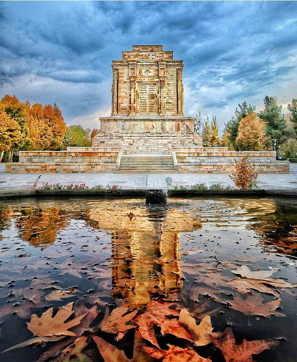
آرامگاه فردوسی در طول این مدت چندین بار بازسازی شد تا دوره هوشنگ سیحون که به سبک زردشتیان باستان، آن را ساختند. ساختمان جدید این آرامگاه محل موزه آثار به جای مانده اسلامی و قبل از آن در دوره های مختلف است. به یاد جنگل های گذشته و آب جاری اطراف توس باستانی، همان اژدهای کشفرود چنبره زده، یک حوضی تحت عنوان حوض نیلوفر احداث کردند و یک باغی که سعی شد درختان بومی توس در آن جمع آوری و نگهداری شود.
اما این همه کار برای احیای توس باستانی نیست و بوم پارک کشفرود برای احیای کشفرود و حفظ اکولوژیکی منطقه در حال احداث است تا بتوان رطوبت منطقه را برای رسیدن به جنگل های توسکا، یادگار نام دیرینه توس باستانی پایدار کرد.
______________________
1- حرم کاظمین مجموعه آرامگاهی است که مدفن امام هفتم شیعیان موسی کاظم و امام نهم شیعیان محمد تقی معروف به جواد در آن قرار دارد و یکی از زیارتگاه های مهم شیعیان می باشد.
The "green Tous (birch)" covered with dense Hyrcanian and alder forests stretched from west to east along the Kashafrud River to the north of Ferdowsi's tomb.
A city that had formed along this river and next to this forest had been cultivating wheat, summer crops, and mulberry trees native to the region for many years. This city and Nishapur were the capitals of the Islamic world, and there was great prosperity along the Silk Road that passed through Kashafrud. The people of Tous built their beautiful houses with wood, brick, stone, and clay. They built the Chaharborj region, which was a military area, around the Kashfrud River, and along with the increase in population, they developed their architectural, pottery, and carpet weaving techniques.
They leveled the hills and valleys of the region and began to cultivate crops. They also built reservoirs, Qanats and streams to irrigate the fields. Various water mills, the remains of which we can see next to Kashfrud, were built in Tous along with this prosperity.
Not many centuries had passed since this prosperity when the city and Nishapur were destroyed by the Mongols in Rabi-ul-Akhr 617 AH (Tajr 599 AH) under the command of Subotai. The Mongols also destroyed the shrine of Imam Reza. They destroyed many of the tile works, forests, and monuments left in Toos and Nishapur. At the same time, in that century, which corresponds to the thirteenth century AD, soil erosion and drought and attacks by desert-dwelling tribes on other temperate regions around the world have been reported in the history of other continents. Although one of the motivations for the Mongols' attack on the temperate Iran was an unprecedented drought in the Mongolian plain.
After this attack, with the wisdom of scholars such as Khwaja Nasir al-Din Tusi, the path of prosperity and progress returned to Toos (his birthplace) and other important cities of Iran during the reign of Hulagu Khan. After the Mongol invasion and the end of the Ismaili rule (635 AH), Hulagu Khan made Khwaja Nasir al-Din his advisor and minister, and he was with Hulagu Khan in Maragheh.
The Radkan Tower, along the Kashfrud River and near Chenaran, which is one of the remains of his observatory and is considered the largest clock in the world, was built during this period.
His life was not enough to fully restore the birch and poplar forests of this region, and after his death, he willed that he be buried in the crypt of Kazemiin and that his tombstone be inscribed as follows:
And their dog spread its paws wide at the entrance. He had willed that only this verse be inscribed on his grave. In the Kazemiin shrine, at the feet of the two Shiite Imams, the name of the Iranian scholar Nasir al-Din Tusi appears. His birthday is on March 5.
The Ferdowsi mausoleum was renovated several times during this period until the era of Houshang Seyhun, who built it in the style of the ancient Zoroastrians. The new building of this mausoleum houses a museum of Islamic relics and before that in different periods. In memory of the past forests and the flowing water around the ancient Tous, the dragon of Kashfarud coiled a pond called the Lotus Pond. They did and a garden where they tried to collect and preserve native birch trees. But all this work is not for the revival of ancient birch, and the Kashfrud Eco Park is being built to revive Kashfrud and preserve the ecological integrity of the area so that the humidity of the area can be sustained to reach the alder forests, a reminder of the ancient name of ancient birch.
______________________
1- The Kazmin Shrine is a mausoleum complex that houses the burial places of the seventh Shiite Imam Musa Kazim and the ninth Shiite Imam Muhammad Taqi, known as Javad, and is one of the important Shiite pilgrimage sites.
معماری یخدان تاریخی چهار برج
_j2jg.jpg)
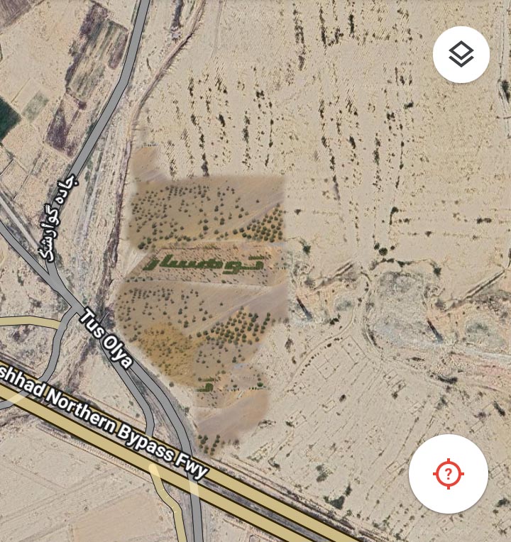
نام رودی که از توس رد میشود کشفرود است. این رودخانه از شرق قوچان و رود اترک سرچشمه میگیرد.
رودخانه ها، علت شکل گیری شهرها هستند. شهر باستانی توس هم در اطراف کشفرود به همین صورت شکل گرفته است، و مردم زیادی ساکنان این شهر شده اند. فردوسی کبیر، اشعار خود را در شهر توس که آن زمان به نام پاژ شناخته میشد میسرود. امروز، آرامگاه او در بوستان بزرگ فردوسی قرار گرفته است که باغی با درختان کهنسال، حوض های زیبا و مجسمه های چشم گیر از داستان رستم و سهراب، رخش رستم، نبرد رستم و اژدها و غیره است.
در کنار این منطقه گردشگری که مقصد بسیاری از مسافران است بازارهای این منطقه شکل گرفته اند. این بازارها نیازهای ریز و درشت ساکنان و تاجران را از بازار ماهی فروشان گرفته تا یخ فروشی در منطقه شاهنامه پوشش می دهند. در این منطقه، حتی یک کارخانه یخ سازی وجود دارد که یخ های قالبی تولید میکند. از دیدنی های ویژه این منطقه یکی مجتمع یخ سازی قدیمی است که در محله چهاربرج قرار دارد.
_fejo.jpg)
برخی بهغلط پیدایش یخدانها را بهخاطر معماری مخروطیشکلی که دارند به دوران مغول نسبت میدهند، ولی برخی اسناد برجایمانده، نشان میدهد که این سازهها، قبل از این هم وجود داشتهاند.
یخدان تاریخی چهار برج مربوط به دوره قاجار است و در شهرستان مشهد، شهر توس، بخش مرکزی، روستای چهاربرج واقع شده و این اثر در تاریخ ۱۶ شهریور ۱۳۸۳ با شمارهٔ ثبت ۱۱۰۸۶ ثبت ملی شده است.
سازمان میراثفرهنگی هم پس از ثبت این یخدان در دهه ۸۰، تاکنون هیچ کمک درخوری برای حفظ بنای یخدان انجام نداده است.
باد و باران در طول سالهای متمادی پوششهای بام را فرسایش داده است. به خصوص در ضلع غربی این فرسایش بسیار مشهود است. به حدی که سقف بنا در این قسمت و جنوب غربی آسیب دیده و ریزش کرده است. مقداری از آجرهای ورودی نیز ریزش کرده، سطح مخزن یخ با سطح اصلی دو و نیم متر اختلاف دارد ،که به گفته اهالی با ریزش سقف و آوارهای آن، کف اصلی قدری پایینتر حدود سه متر است.
نحوه کار در یخدان تاریخی چهار برج
_lvft.jpg)
اهالی در مراسمی در شش شب متوالی، آب را در استخر به یخ تبدیل میکردند. شب اول، آب جوی را رها میکردند تا حدود 25 الی 30 سانتیمتر در استخر ذخیره شود. این آب تا شب بعد یخ میزد و بعد شب دوم دوباره همین مقدار آب رها میکردند، تا شب آخر که عمق یخ به حدود یک تا یک و نیم متر میرسید.
چرا آب را مستقیماً داخل یخدان سر نمیدادند؟
اول اینکه آب داخل یخدان یخ نمیزد، در ثانی ممکن بود بنا را خراب کند؛ چون بنا آجری و از خشت خام است. این بنا سیمان و خشت پخته نبوده است.
در میان یخدانهای به جا مانده، یخدان چهاربرج به دلیل استفاده از چوب در مصالح، کمتر دچار تخریب شده است و میتواند با هزینهای بسیار اندک مرمت و بازسازی شود. این بنا مثل هر بنای تاریخی دیگر در فهم تاریخ و هویت گذشتگان به ما کمک میکند و نبودش در آینده مشکلزا خواهد شد.
برای مثال میتوان به یخدان مؤیدی کرمان اشاره کرد که مدتی به عنوان کانون پرورش فکری کودکان و بعد به دفتر گردشگری تبدیل شد و در حال حاضر به عنوان زورخانه استفاده میشود. امیدوارم که مسئولین زیربط قبل از آنکه دیر شود فکری برای حفظ یخدان چهاربرج کنند.
_l7su.jpg)
حاج محمد وثوق، مالک یخدان، فردی خیرخواه بود و در مقابل افرادی که آن روزها قصد تخریب یخدان را داشتند، ایستاد. او قبل از ثبت یخدان به عنوان اثر ملی از آن به عنوان میراثی از گذشتگان یاد میکرد که باید برای آیندگان حفظ شود.
برخی میراث فرهنگی نزدیک پل فردوسی کشفرود عبارتند از:
«یخدان قدیمی چهاربرج» با قدمت دویست ساله، «انبارهای قدیمی غلات»، «موزه هنرهای پهلوانی شه لافتی» و «خانههای بومگردی» متعدد در کنار جاذبه های دیدنی باغ های توس.
پانویس: روستای چهاربرج
قدمت سکونت در روستای چهاربرج و ساخت قلعه قدیمی حداقل به سه قرن پیش بازمیگردد و از محلات محوری در طول بولوار شاهنامه بوده است. این مطلب را میتوان از وجه تسمیه خود روستا فهمید، چهار برج یعنی روستایی که دارای چهار برج است یا اصطلاحا دژ در اطراف آن ساخته شده است. بیشتر روستاهای این منطقه مثل شمس آباد، و احمدآباد مقبل دارای دو برج کوچک در محل درب ورودی قلعه بودند. به گفته پیران قدیمی روستا این برجها که تا نیمقرن پیش آثارشان وجود داشت، حالتی نظامی و مستحکم داشتند و در سدههای قبل نقش قلعه و برج نظامی را ایفا میکردند. حتی برخی معتقدند که اولین ساکنان چهاربرج نیروهای نظامی دولت بودند که برای مقابله با دشمنان خارجی از جمله ترکمنها و ازبکها به مشهد در این قلعه ساکن شدهاند. این اهمیت نظامی تا دوران قاجار ادامه پیدا میکند. نقل است که در زمان حمله ترکمنها ساکنان و مردمان نواحی اطراف برای حفظ جان خود به این قلعه (روستای چهاربرج) پناهنده میشدند.
______________________
The name of the river that flows through Tous is Kashafrud. This river originates from the east of Quchan and the Atrak River.
Rivers are the reason for the formation of cities. The ancient city of Toos was also formed around Kashfrud, and many people have settled in this city. Ferdowsi the Great composed his poems in the city of Toos, which was then known as Pazh. Today, his tomb is located in the Ferdowsi Grand Park, which is a garden with old trees, beautiful ponds, and impressive sculptures from the stories of Rostam and Sohrab, Rakhsh of Rostam, the Battle of Rostam and the Dragon, etc.
Markets have formed in this area next to this tourist area, which is a destination for many travelers. These markets cover the small and large needs of residents and merchants, from the fish market to the ice shop in the Shahnameh region. In this area, there is even an ice factory that produces block ice. One of the special sights of this area is the old ice complex located in the Chaharborj neighborhood.
Some mistakenly attribute the emergence of ice rinks to the Mongol era due to their conical architecture, but some surviving documents show that these structures existed before this.
The historical ice rink of Chahar Borj dates back to the Qajar era and is located in the central district of Toos city, Mashhad city, Chahar Borj village, and this work was registered nationally on September 6, 2004 with registration number 11086.
The Cultural Heritage Organization has not done any proper help to preserve the ice rink since registering this ice rink in the 2000s.
Over the years, wind and rain have eroded the roof coverings. This erosion is especially evident on the western side. To the extent that the roof of the building in this part and the southwest has been damaged and collapsed. Some of the entrance bricks have also fallen, and the level of the ice tank is two and a half meters lower than the original level. According to the residents, the original floor is slightly lower, about three meters, due to the collapse of the roof and its debris.
How the historic ice tank works
The residents would turn the water in the pool into ice in a ceremony for six consecutive nights. On the first night, they would release the stream water until it was stored in the pool to a depth of about 25 to 30 centimeters. This water would freeze until the next night, and then on the second night, they would release the same amount of water again, until the last night when the ice depth reached about one to one and a half meters.
Why didn't they pour the water directly into the ice tank?
First, the water inside the ice tank wouldn't freeze, and second, it could have destroyed the building, because the building is made of raw brick. This building was not made of cement or baked brick.
Among the remaining icehouses, the Chaharborj Icehouse has suffered less damage due to the use of wood in its materials and can be restored and renovated at a very low cost. Like any other historical monument, this building helps us understand the history and identity of the past, and its absence will be problematic in the future.
For example, we can mention the Moayedi Icehouse in Kerman, which was used as a children's intellectual development center for a while and then turned into a tourism office and is currently used as a brothel. I hope that the relevant authorities will think about preserving the Chaharborj Icehouse before it is too late.
Haj Mohammad Vosouq, the owner of the icehouse, was an intellectual and stood up to those who wanted to destroy the icehouse in those days. Before registering the icehouse as a national monument, he referred to it as a legacy of the past that should be preserved for future generations.
Some cultural heritage sites near the Ferdowsi Kashfrud Bridge include:
The two-hundred-year-old "Old Chahar Borj Icehouse", "Old Grain Warehouses", "Shah Lafati Pahlavi Arts Museum" and numerous "Economic Houses" alongside the spectacular attractions of Toos Gardens.
Footnote: Chahar Borj Village
The settlement in Chahar Borj Village and the construction of the old castle date back at least three centuries and it was one of the central neighborhoods along Shahnameh Boulevard. This can be understood from the name of the village itself, Chahar Borj means a village with four towers or, so to speak, a fortress built around it. Most villages in this area, such as Shamsabad and Ahmadabad Moqbel, had two small towers at the entrance to the castle. According to the village elders, these towers, whose remains existed until half a century ago, had a military and fortified appearance and played the role of a castle and a military tower in previous centuries. Some even believe that the first inhabitants of Chaharborj were the government military forces who settled in this castle to confront foreign enemies, including the Turkmen and Uzbeks, in Mashhad. This military importance continued until the Qajar era. It is said that during the Turkmen attack, the residents and people of the surrounding areas took refuge in this castle (Chaharborj village) to save their lives.
ترمیم و پایدارسازی دیواره ساحلی رودخانه کشفرود
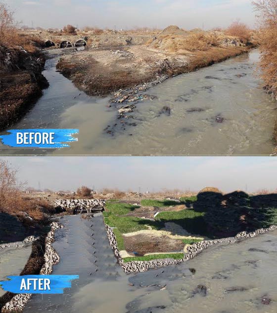
رودخانهها در مسیر حرکت خود بر سطح زمین، بر اثر تغییرات مداوم جریان آب و ویژگیهای طبیعی بستر، دچار پیچوخمها، تراکمها و شکافهایی میشوند که بهتدریج ساختار طبیعی حاشیه رودخانه را شکل میدهند. با گذشت زمان و بهویژه در هنگام وقوع سیلابها یا افزایش ناگهانی دبی جریان، کنارههای رودخانه دچار فرسایش و تخریب میشوند و این امر ضرورت اجرای عملیات ترمیم و تثبیت را افزایش میدهد.
به منظور جلوگیری از گسترش فرسایش و حفظ پایداری سازهای و اکولوژیک رودخانه، اجرای پروژههای مرمت خط ساحلی ضروری است. این پروژهها معمولاً شامل مجموعهای از اقدامات مهندسی و زیستمحیطی نظیر:
سنگچینی و لایهچینی محافظتی در بخشهای آسیبپذیر،
شنریزی و تسطیح بستر برای ایجاد پایداری بیشتر،
درختکاری و کاشت گیاهان بومی جهت تقویت ریشهزایی و ایجاد مقاومت طبیعی در برابر فرسایش.
اجرای صحیح این اقدامات علاوه بر جلوگیری از تخریب بیشتر، به بهبود کیفیت محیط زیست رودخانه، تثبیت خاک، افزایش تنوع زیستی و بازگشت تدریجی محیط به حالت طبیعی نیز کمک میکند. در نتیجه، مرمت دیواره ساحلی نه تنها اقدامی حفاظتی است، بلکه نقش مهمی در حفظ پویایی و سلامت اکوسیستم رودخانه نیز ایفا میکند.
__________________
Riverbank Restoration and Stabilization
As rivers flow across the surface of the land, they undergo continuous changes caused by water dynamics and the natural characteristics of the riverbed. These processes gradually create meanders, bends, and fissures that shape the natural structure of the riverbank. Over time, and especially during floods or sudden increases in discharge, the riverbanks become vulnerable to erosion and degradation, making restoration and stabilization measures increasingly necessary.
To prevent further erosion and preserve both the structural and ecological stability of the river, implementing shoreline restoration projects is essential. These projects typically include a combination of engineering and environmental actions such as:
Stone masonry and protective layering in vulnerable sections,
Gravel placement and bed leveling to increase stability,
Tree planting and the use of native vegetation to strengthen root systems and create natural resistance against erosion.
Proper implementation of these measures not only prevents further degradation but also contributes to improving the river’s environmental quality, stabilizing the soil, enhancing biodiversity, and gradually restoring the ecosystem to its natural state. Therefore, riverbank restoration is not merely a protective intervention—it also plays a vital role in maintaining the dynamism and ecological health of the river system.
کهنترین روستای شرق ایران، روستای توپ درخت کشفرود
کشفرود باستانی، که قدمتش به دوره قبل از پارینه سنگی برمیگردد، همچنان زیستگاه پرندگان بومی منطقه است و پرنده نگاران مختلف برای ثبت تصاویر آن تورهای پرنده نگری تشکیل میدهند. یکی از این مقاصد آنها تپه «توپدرخت» است که قدمتش را دوران پیش از تاریخ ایران تخمین زدهاند. این اثر باستانی که مهر۱۳۸۰ با شمارهثبت۴۰۲۸ بهعنوان یکی از آثار ملی ایران به ثبت رسیده است، در مجاورت روستایی بههمیننام قرار دارد که در نزدیکی مشهد و شهر توس است.
در توپ درخت، مقدار زیادی از قطعات ظروف سفالین منقوش و ساده، سردوک و دستهآسهای سنگی وجود داشته که نشاندهنده غنای فرهنگی، دیرینگی و استقرار طولانیمدت اقوام در طول دورانهای مختلف تاریخی در این نقطه بوده است.
محوطه توپ درخت در دوران پیش از میلاد مسیح، زیستگاه تمدنهای مختلف بوده است. ساکنان امروز روستای توپ درخت در اطراف این منطقه باستانی استقرار یافته اند. با وجود این آثار به جا مانده تمدن غنی را در منطقه ای کمی دورتر از روستای امروزی نشان میدهد.
به استناد سفالها و شواهد کشفشده، توپدرخت، کهنترین روستای شرق ایران و یکی از شهرهای بزرگ دشت توس در دوره برنز بوده است که از آن به عنوان یکی از زیستگاههای مهم انسان در کانون تمدن کشفرود نیز یادمیشود.
از رونق و آبادانی این روستا و شهرهای بسیاری در اطراف کشفرود در هزاره نخست اسلامی کاسته شده و در عصر صفویه دوباره بر ویرانههای بناهای باستانی آن، روستای جدیدی نبا نهاده شده یا ساکنان جدیدی در این منطقه مستقر شدند.
در مشهد، نامواژههایی با ریشه نام درخت و گل و گیاه کم نیستند، از جمله توپدرخت، کجدرخت، برگ، بوتهگز، درختبید، سنجدک، سیرزار، باغچه، بیدک، بوتهمرده و درختسفیدار، درخت سنجد، توس و توسکا، اقاقیا. همگی اینها، ناممحل های روستاهایی در اطراف کشفرود هستند.
درباره روستای توپدرخت در لغت نامه دهخدا آمده است که:
توپ درخت . [ دِ رَ ] (اِخ ) دهی از دهستان میان ولایت است که در بخش حومه ٔ شهرستان مشهد و بر کنار کشف رود واقع است و 225 تن سکنه دارد. (از فرهنگ جغرافیایی ایران ج 9).
علت نامگذاری روستای توپ درخت میتواند به شکل درخت بزرگی باشد که چتر کاملا گردی بر روی ساقه تنومند آن قرار گرفته باشد. همچنین میتواند منظور، درخت بزرگ و منطقه ای با سرسبزی انبوه درختان باشد که هم اکنون نیز این وجه تسمیه در روستای قره جنگل و جنگلی با این نام (قره جنگل سپیدار) در اطراف به چشم میخورد. احتمال دیگر آن است که در کابرد ابریشم بافی (نوغان داری) از درخت مشخصی در روستا استفاده میشده است. احتمالی که اکنون به نظر میرسد صحیح باشد وجود گونه گیاهی با نامی شبیه به توپ درخت است که در متون علمی امروز گلوله درخت نامیده میشود. برای آشنایی بیشتر در همین متن توضیحاتی درباره این درخت ویژه ارائه میشود:
درخت گلوله توپ
شرایط اقلیمی: کمی مرطوب،
درجه حرارت: نیمه گرمسیری تا گرمسیری
خاک: غنی
این درخت میوه های گرد و مانند گلوله توپ دارد که وقتی رسیده باشد به طور ناگهانی از درخت به زمین می افتند و در برخی مواقع میوه های رسیده موقعی که به زمین می خورند با صدا می ترکند. میوه های این درخت خوراکی هستند، اما به دلیل طعم خاص، معمولاً توسط انسانها مصرف نمی شوند و عمدتاً به مصرف تغذیه حیوانات می رسند. این درخت در هندوستان درخت مقدسی محسوب میشود.
البته توپ درخت میتوانسته اشاره به درختان دیگری مثل درخت میوه پاپایا یا خربزه درختی داشته باشد.
میوه پاپایا فرازگرا است. این میوه قابلیت رسیدن پس از برداشت را دارد. یعنی هنگام برداشت میتوان میوه را به شکل نارس جمع آوری کرد و مدتی در انبار نگهداری کرد، و یا به نقاط دوردست فرستاد. میوه بالغ پاپایا دارای پوستی نازک است و نگهداری و حمل و نقل آن نیاز به دقت فراوان دارد.
____________
The ancient river, which dates back to the pre-Paleolithic period, is still the habitat of the region's native birds, and various ornithologists organize bird-watching tours to capture images of it. One of their destinations is the "Top-Derkht" hill, which they estimate to be from the prehistoric era of Iran. This ancient monument, which was registered as one of the national monuments of Iran in Mehr 2000 with registration number 4028, is located in the vicinity of a village of the same name near Mashhad and the city of Toos.
In Top-Derakht, there were a large number of fragments of painted and plain pottery vessels, sardoks, and stone aces, which indicate the cultural richness, antiquity, and long-term settlement of peoples in this place during different historical periods.
The Top-Derkht area was the habitat of various civilizations during the BC era. Today's residents of Toup-Derkht village have settled around this ancient area. Despite these remains, it shows a rich civilization in an area a little further away from the present-day village.
According to the pottery and evidence discovered, Topdarkht was the oldest village in eastern Iran and one of the major cities of the Toos Plain in the Bronze Age, which is also remembered as one of the important human habitats in the center of the Kashfrud civilization.
The prosperity and development of this village and many cities around Kashafrud declined in the first Islamic millennium, and in the Safavid era, a new village was built on the ruins of its ancient buildings or new residents settled in the area.
In Mashhad, there are many nouns with the roots of trees, flowers, and plants, including Topdarkht, Kajdarkht, Barg, Butehgaz, Willow Tree, Sanjdak, Sirzar, Baghche, Bidak, Butehmardeh and Safidar Tree, Elderberry Tree, Birch and Touska (Alder), Acacia. All of these are place names of villages around Kashfrud.
Regarding the village of Topdarkht, the Dehkhoda dictionary states:
Topdarkht. [ دِ رَ ] (خ) is a village in the rural district of Mian Velayat, which is located in the suburbs of Mashhad city and next to Kashfrud and has a population of 225 people. (From the Geographical Dictionary of Iran, Vol. 9).
The reason for naming the village Topdarkht could be the shape of a large tree with a completely round umbrella on its sturdy stem. It could also mean a large tree and an area with dense greenery of trees, which is still the case in the village of Qara Jangal and a forest with this name (Qara Jangal Sepidar) around it. Another possibility is that a specific tree was used in the village in the use of silk weaving (noghan dari). The possibility that now seems to be correct is the existence of a plant species with a name similar to Topdarkht, which is called Gulle Darakht in today's scientific texts. For more information, here is a description of this special tree:
Cannonball Tree
Climate conditions: Slightly humid,
Temperature: Subtropical to tropical
Soil: Rich
This tree has round, cannonball-like fruits that suddenly fall from the tree to the ground when ripe, and sometimes the ripe fruits crackle when they hit the ground. The fruits of this tree are edible, but due to their special taste, they are not usually consumed by humans and are mainly used as animal feed. This tree is considered a sacred tree in India.
Of course, the cannonball tree could refer to other trees such as the papaya fruit tree or the tree melon.
The papaya fruit is ascending. This fruit has the ability to ripen after harvest. That is, when harvested, the fruit can be collected unripe and stored for a while in storage, or sent to distant places. The mature papaya fruit has a thin skin and requires great care in storage and transportation.
حیات وحش کشفرود: نقش وزغها، مارمولکها و اکولوژی رودخانه
رودخانهٔ کشفرود نه تنها مسیری برای عبور آب، بلکه جریانی زنده است که اکوسیستمهای متنوعی را در امتداد خود شکل میدهد. در حاشیه و بستر کشفرود، گونه های مختلفی از دوزیستان و خزندگان زندگی میکنند که هر یک به شیوهای خاص با این رودخانه سازگار شدهاند.
---
دوزیستانِ کشفرود؛ پیوند میان آب و خشکی
وزغها و قورباغهها از مهمترین جانورانی هستند که چرخهٔ زندگی آنها با کشفرود ارتباط مستقیم دارد. حضور آنها در برکه ها، گودالهای آبی و پهنههای آرام آب در امتداد کشفرود، نمونهای روشن از رابطهٔ دیرینهٔ دوزیستان و رودخانه هاست.
نقش رودخانهٔ کشفرود در زندگی دوزیستان
کشفرود محیطی مناسب برای تخمگذاری وزغها فراهم میکند.
لاروهای دوزیستان در آبهای آرام کشفرود از حشرات ریز آبزی تغذیه میکنند.
دمای مناسب و رطوبت ثابت حاشیهٔ کشفرود به حرکت و فعالیت روزانهٔ قورباغهها کمک میکند.
نوار رطوبتی کشفرود زیستگاهی امن برای پناه گرفتن دوزیستان در ساعات گرم روز است.
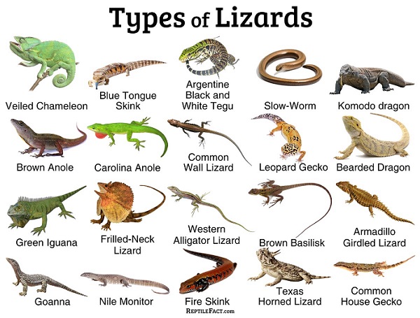
در بسیاری از روستاهای مسیر کشفرود (مثل دهشک، سهل الدین، فیلیان قائم مقام، توپدرخت، چاه ملا، قره جنگل، پری آباد، چشمه گیلاس، مهرآباد، چمله کلاته تلکی، درخت سنجد و غیره)، صدای وزغها و قورباغهها بخشی از هویت طبیعی این رودخانه محسوب میشود. برخی از انواع مارمولک خانگی · ایگواناهای دریایی · مارمولک باسیلیسک سبز ·
آنول مارمولک · دراکو مارمولک · آگاما مارمولک · اژدهای کومودو یک مارمولک
بزرگ · وزغ شاخدار یا مارمولک شاخدار فقط نام برخی از گونه های مارمولک هستند.
 مارمولکها و سوسمارها در حاشیهٔ کشفرود
حاشیهٔ کشفرود با پوشش گیاهی پراکنده، سنگچینهای طبیعی و خاکهای گرم، محیط مناسبی برای مارمولکها فراهم میکند. مارمولکها در این منطقه نه تنها از فراوانی حشرات برخوردارند، بلکه از سایه سار بوتههای کنار کشفرود برای تنظیم دمای بدن و پناه گرفتن استفاده میکنند.
نقش مارمولکها در پویایی منطقهٔ کشفرود
شکار حشرات فراوان اطراف کشفرود
تامین بخشی از غذای پرندگان حاشیهٔ رودخانه
حضور در نوار زیستی میان خشکی و رطوبت کشفرود
ایجاد تعادل میان زنجیرههای غذایی در اطراف رودخانه
مردم بومی در ناحیهٔ کشفرود مارمولک را «کَلپاسه» مینامند؛ واژه ای که بخشی از فرهنگ قدیمی ساحل نشینان این رودخانه است.
---
ضَب و نامهای بومی در مسیر کشفرود
هرچند ضَب بیشتر در مناطق گرم و جنوبی زیست دارد، اما در بخشهایی از مسیرهای جنوبی تر حوزهٔ کشفرود نیز نام و روایتهایی از این جانور شنیده میشود.
نامهایی مانند «چِلپاسه» و «کَلپاسه» نشاندهندهٔ پیوند طولانی میان مردم و طبیعت کشفرود است؛ پیوندی که در آن نام جانوران بخشی از حافظهٔ فرهنگی رودخانه شده اند.
---
کشفرود؛ محور تنوع زیستی و رفتار جانوران
از دید یک زیستشناس آبهای داخلی، کشفرود شبکهای طبیعی از ریززیستگاههاست که دما، رطوبت، نور و مواد غذایی را در طول مسیر تغییر میدهد. همین تغییرات است که رفتارهای جالبی را در جانوران اطراف رودخانه شکل میدهد.
رفتارهای وابسته به کشفرود
آفتابگیری مارمولکها بر سنگهای گرمشدهٔ ساحل کشفرود
فعالیت شبانهٔ وزغها در رطوبت شبانهٔ ساحل رودخانه
دگردیسی لاروهای دوزیستان در آبهای کمعمق کشفرود
حرکت خزندگان کوچک میان بوتههای نمدار اطراف رودخانه
پویایی حشرات آبزی که غذای بسیاری از جانوران حاشیهٔ کشفرود را تشکیل میدهند
کشفرود در هر فصل ظاهری تازه دارد و جانوران نیز هماهنگ با ریتم این رودخانه رفتارهای جدیدی از خود نشان میدهند.
---
سخن پایانی
کشفرود، از سرچشمه تا دشتهای مرکزی، نه تنها سیمای جغرافیایی منطقه را شکل میدهد، بلکه مجموعهای از وزغها، قورباغهها، مارمولکها و سوسمارهای کوچک را در خود جای میدهد. این جانوران حلقههایی از یک هویت طبیعیاند که به طور مستقیم با ریتم آب، رطوبت و پوشش گیاهیِ حاشیهٔ کشفرود پیوند خورده است.
________________________
1- چلپاسه . [ چ َ س َ / س ِ ] نوعی از ضب است که سوسمار باشد و آن را وزغه نیز گویند و آن کوچکترین اجناس سوسمار است.
_____________________________
Types of Lizards
The Kashfrud River is not only a path for water to pass through, but also a living stream that forms diverse ecosystems along its length. On the banks and bed of the Kashfrud, various species of amphibians and reptiles live, each of which has adapted to this river in a special way.
---
Kashfrud Amphibians; The Link Between Water and Land
Toads and frogs are among the most important animals whose life cycle is directly related to the Kashfrud. Their presence in ponds, water holes, and calm water areas along the Kashfrud is a clear example of the ancient relationship between amphibians and rivers.
The role of the Kashfrud River in amphibian life
The Kashfrud provides a suitable environment for toads to lay eggs.
Amphibian larvae feed on small aquatic insects in the calm waters of the Kashfrud.
The suitable temperature and constant humidity of the Kashfrud margin help frogs move and do their daily activities.
The Kashfrud wetland is a safe habitat for amphibians to take refuge in during the hot hours of the day.
In many villages along the Kashfrud route (such as Dehshak, Sahl al-Din, Filian Ghaem-Maqam, Topdarkht, Chah Molla, Qara Jangal, Pari Abad, Cheshme Gilas, Mehr Abad, Chamleh Kalateh Telaki, Derakteh Senjed, etc.), the sounds of toads and frogs are part of the natural identity of this river. Some types of house lizards · Marine iguanas · Green basilisk lizard · Anole lizard · Draco lizard · Agama lizard · Komodo dragon a large lizard · Horned toad or horned lizard are just the names of some lizard species.
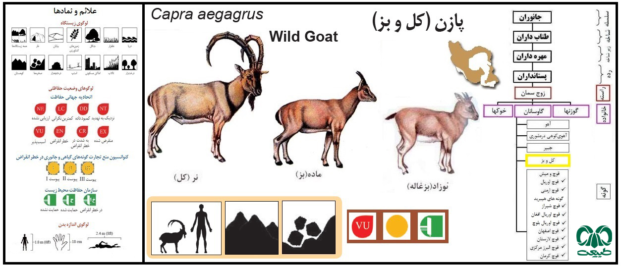
In the local dialect of the Kashfrud people, lizards are called "kal passe"1. I don't know the reason for this name. Because we also have kal and goats that are found in the wild and are the ancestors of domestic goats. This naming goes back to ancient times. All lizards and lizards on the banks of the Kashfrud River
The banks of the Kashfrud River, with their scattered vegetation, natural rock formations, and warm soils, provide a suitable environment for lizards. Lizards in this area not only enjoy an abundance of insects, but also use the shade of the bushes along the Kashfrud River to regulate their body temperature and take shelter.
The role of lizards in the dynamics of the Kashfrud River
Prey on the abundant insects around the Kashfrud River
Provide some of the food for birds on the banks of the river
Presence in the biome between the dry and humid areas of the Kashfrud River
Creating a balance between the food chains around the river
The indigenous people in the Kashfrud River area call lizards "kalpaseh"; a word that is part of the ancient culture of the people living on the banks of this river.
---
Zab and local names along the Kashfrud River
Although the zab lives mostly in warm and southern regions, names and stories about this animal can also be heard in parts of the more southern routes of the Kashfrud basin.
Names such as "Chelpaseh" and "Kalpaseh" indicate a long connection between the people and nature of the Kashfrud; a connection in which the names of the animals have become part of the river's cultural memory.
---
Kashfrud; the axis of biodiversity and animal behavior
From the perspective of an inland water biologist, the Kashfrud is a natural network of microhabitats that change temperature, humidity, light, and nutrients along the way. It is these changes that shape interesting behaviors in the animals around the river.
Behaviors associated with the Kashafrud River
Lizards sunbathing on the heated rocks of the Kashafrud River
Nocturnal activity of toads in the nighttime humidity of the riverbank
Metamorphosis of amphibian larvae in the shallow waters of the Kashafrud River
Movement of small reptiles among the moist bushes around the river
Dynamics of aquatic insects that form the food of many animals on the banks of the Kashafrud River
The Kashafrud River has a new appearance in every season, and animals also show new behaviors in harmony with the rhythm of this river.
---
Concluding Remarks
The Kashafrud River, from its source to the central plains, not only shapes the geographical landscape of the region, but also houses a collection of toads, frogs, lizards, and small lizards. These animals are rings of a natural identity that is directly linked to the rhythm of water, humidity, and vegetation on the banks of the Kashafrud River.
________________________
1- Chelpaseh. [Ch َ س َ / س ِ] is a type of lizard, also called a toad, and it is the smallest species of lizard.