
Kashafrud river - رودخانه کشف رود
اینجا درباره رودخانه کشفرود ایران مینویسم
Kashafrud river - رودخانه کشف رود
اینجا درباره رودخانه کشفرود ایران مینویسمدرباره من
 از اونهام که می گم آدم بایست حرف خودشو بزنه، اما یاد گرفتم که هر حرفی رو تو جاش بزنم، اینجا، هرچی می خوام رو می گم
ادامه...
از اونهام که می گم آدم بایست حرف خودشو بزنه، اما یاد گرفتم که هر حرفی رو تو جاش بزنم، اینجا، هرچی می خوام رو می گم
ادامه...
ساحل مکران و سرایان
سرایان و سراوان
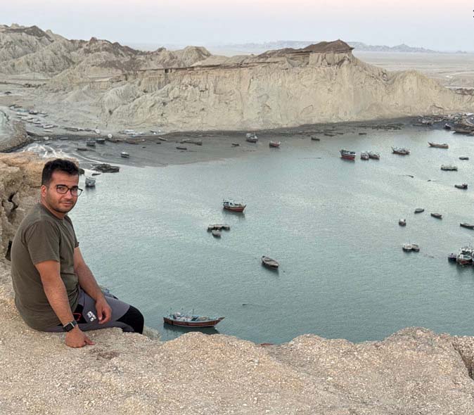
«سرایان» به معنی «ساکنان» یا «موجودات در یک سرا» است و بسته به متن و جمله میتواند معانی مختلفی داشته باشد.
«سراوان» بر وزن فراوان از دو کلمه «سرا» به معنی «مکان» + «وان» به معنای «بلندی» تشکیل شده که به «جای بلند» اشاره دارد. همچنین سراوان میتوانسته به صورت سرآبان تلفظ شود که به معنی سر آب ها باشد. خیلی جاها در ایران و افغانستان به آب، آو میگویند.
هر دو کلمه سرایان و سراوان ارتباطی هم با سوران به دلیل پرآبی دارند. سوران در لغتنامه دهخدا با کلمه سار آمده است:
اشاره به خوش آوازی پرندگان منطقه دارد.
سوران به کردی جمع سور به معنی شادی است. سوران در ترکی به معنی سرزمین دارای آب است که با توجه به نامگذاری های مشابه ترکی در منطقه میتوان به اشتراک نامگذاری پی برد. قدمت این نامگذاری ها ممکن است به زمان حکومت مغول بازگردد.
در ایران مناطقی با نام سوران داریم که اغلب مناطق نزدیکی آب و رودخانه هستند. نکته جالبتر اینکه مجموعه این نامگذاری ها احتمالا توسط یک نفر صورت گرفته و در چند نقطه در اطراف رودخانه ها در کشور تکرار شده است:
جایی که سوران داریم هوشک نیز داریم.
میتوان ریشه هوشک را باستانی و در زبان پهلوی بدین صورت یافت:
هوش. نویسه گردانی: HWŠ. [پارسی باستان و سغدی: اوشیا ūŝyâ؛ اوستایی: اوش éŝ
در شمال مشهد، در انشعابات کشفرود، پارک جنگلی سوران داریم که کمی آنطرف تر دهوشک یا دهشک نیز یافت میشود. روستای دهشک خراسان رضوی، بخصوص با افزایش فتوحات نادرشاه افشار شهرت بیشتری یافت. مشابه این نامگذاری در سیستان و بلوچستان هم وجود دارد. در سیستان و بلوچستان هم مانند روستای دهشک که نزدیک سوران است، یک مجموعه نامگذاری با سراوان، سوران و هوشک قرینه یابی میشود.
سرایان سیستان و بلوچستان با «دره باز» مکانی اطراف رودخانه است که نشان از پرآبی از سمت قائن به سمت مرزهای ایران دارد.
دهوشک و دهشک = دِه+هُشَک: دهشک
هوشک و هُشَک
نکته جالب یافتن نامگذاری های مشابه از حیث وجود موجودات دریایی در این مناطق است. نزدیک دهشک و جایی در چناران کشفرود روستای قره کوسه را می یابیم. همانطور که به طور مشابه روستای نهنگ را در نزدیکی سواحل مکران سیستان و بلوچستان می یابیم. می توان پی برد که کوسه و نهنگ دو موجود آبزی مجزا بوده و هر دو نام روستاهایی در ایران بوده اند. در گذشته بقدری پهنه رودهای ایران وسیع بوده است که موجودات بزرگ دریایی تا دریای خزر رفت و آمد داشته اند. در کتاب شاهنامه فردوسی در داستانی آمده است که روزی اژدهایی در کشفرود پرآب در مسیر جریان آن قرار میگیرد و مانع از حرکت قایق ها شده و سیلابی ایجاد میشود. یکی از کارهای پهلوانان باز کردن مسیر رودخانه و مبارزه با آن اژدها بوده است. این اشاره، عظیم الجثه بودن موجود آبزی را نشان می دهد.
نهنگ و مرز آبی ایران و پاکستان
در سمت کوه های آتشفشانی تفتان، دریاچه هامون و پرآبی بوده است. این دریاچه تا آنجا که قلعه سیب و سوران در سیستان و بلوچستان نام بگیرد، امتداد داشته است. با بروز خشکسالی های پی در پی از طول آمودریا و جیحون کاسته شده و نامهای ریزآبه های آن یعنی هلمند و هیرمند برجای مانده اند: مند در هر دو نام رودخانه به معنای خدا و صاحب است. ریشه این کلمات زرتشتی بوده و مانند هُش که آن هم اشاره به خدا میتوانسته داشته باشد، اشاره به باورهای آیینی زرتشت داشته است.
به نظر میرسد خصوصا تا قبل از مرزبندیهای جغرافیایی کشورها که منجر به انحصار طلبی آنها پس از یک دوره خشکسالی در قرن سیزدهم و حمله مغول در ایران میشده است رود سرتاسری و بزرگی تا جای آمودریای امروزی جاری بوده است که به مرور تکه تکه و دریاچه مانند شده و کم کم خشک شده اند. این تکه تکه شدن، زیستگاه موجودات حیات وحش منطقه را به خطر انداخته و برخی را تا حد انقراض امروزی پیش برده است.
آمودریا با دریای هند
آمودریا یا جیحون هنوز رودی پرآب در آسیاست. تا پیش از حمله اعراب در قرن اول اسلامی، کسی به این رودخانه جیحون نمی گفته است. نام دیگر معروف تر آن در منطقه آمودریا است. یعنی رود خانه یا دریای آمو که آمو هم اشاره دارد به شهری به اسم آموی در ساحل چپ آمودریا که امروز به آن شهر ترکمن آباد میگویند.
آمودریا، رودی در آسیای میانه است، به طول حدود 2540 کیلومتر، با مسیر عمومی شرقی ـ غربی که به دریاچه آرال (بحر خوارزم *) میریزد. در مقایسه با طول باقیمانده کشفرود امروزی که 294 کیلومتر است، این رودخانه طول بسیار زیادی دارد.
ضرورت احیای ایرانرود
شوروی سابق تا قبل از تکه تکه شدن در قرن بیست مسیر آمودریا به دریای خزر را تغییر داده و بر خشکی حوضه آبریز قره قوم و در پی آن کشفرود و انقراض موجودات حیات وحش آن افزوده است.
زمین لرزه ها و فعالیت کوه های آتشفشانی مثل تفتان در این خشکسالیهای چند قرن اخیر نیز موثر بوده است. قراردادها و مرزبندی های جغرافیایی قرن های پانزده تا بیست نیز در افزایش شدت خشکسالی در منطقه موثر هستندد.
پس از جیحون که طی چند قرن و با قرارداد و جابجایی و تکه تکه شدن، خشک شده و رود کوچکی در میانه آسیا تعریف شد به ضرورت احیای ایرانرود میرسیم. پروژه ای که طرح آن از دوره خوارزمشاهیان شکل گرفت و تا به امروز که نیاز به آن بیش از پیش احساس میشود، روی میز مسئولان است.
ایرانرود که میتواند از نیمه کشور متحد و یکپارچه ایران بگذرد و میتواند اندکی جای جیحون باستانی را بگیرد تا آب را به روستاها برساند و در نهایت از خشکی بیش از پیش دریای خزر جلوگیری کند.
__________________________
Sarayan and Saravan
Makran Coast - Sistan and Baluchestan
"Sarayan" means "residents" or "creatures in a house" and can have different meanings depending on the context and sentence.
"Saravan" is composed of two words "sara" meaning "place" + "van" meaning "height" which refers to a "high place".
Both words Sarayan and Saravan are also related to Soran due to its abundance of water. Sooran is mentioned in the Dehkhoda Dictionary with the word Sar:
It refers to the beautiful singing of the birds in the region.
Soran in Kurdish is the plural of Sur meaning happiness. Soran in Turkish means a land with water, which can be traced back to the time of the Mongol rule, considering similar Turkish names in the region. The history of these names may go back to the time of the Mongol rule.
In Iran, we have areas called Soran that are often areas near water and rivers. The most interesting thing is that this set of names was probably made by one person and repeated in several places around the rivers in the country:
Where we have Soran, we also have Hooshak.
The root of Hooshk can be found in ancient Pahlavi as follows:
Hoosh. Transliteration: HWŠ. [Ancient Persian and Sogdian: Oshia ūŝyâ; Avestan: Osh éŝ
In the north of Mashhad, at the branches of the Kashfrud, we have the Soran Forest Park, which is also found a little further away as Dehushak or Deheshk. The village of Dehshak in Khorasan Razavi, especially with the increase in the conquests of Nader Shah Afshar, became more famous. Similar names exist in Sistan and Baluchestan. In Sistan and Baluchestan, like the village of Dehshak near Soran, a set of names with Saravan, Soran, and Hooshk is found.
Sarayan Sistan and Baluchestan with "Dare Baz" is a place around the river that indicates a high water level from the direction of Qaen towards the borders of Iran.
Dehushk and Dehshak = Deh+Hushak: Dehshak
Hushak and Hushak
An interesting point is finding similar names in terms of the presence of marine creatures in these areas. Near Dehshak and somewhere in Chenaran, we find the village of Qara Kose. Similarly, we find the village of Nahang near the coast of Makran, Sistan and Baluchestan. It can be seen that Kose and Nahang were two separate aquatic creatures and both were the names of villages in Iran. In the past, the rivers of Iran were so wide that large marine creatures traveled all the way to the Caspian Sea. In the book of Shahnameh by Ferdowsi, there is a story that one day a dragon in the Kashafrud river was in the path of its flow, preventing the movement of boats and causing a flood. One of the tasks of the heroes was to open the river and fight the dragon. This reference shows the huge size of the aquatic creature.
Whale and the Water Border of Iran and Pakistan
On the side of the volcanic mountains of Taftan, there were Hamun and Parabi lakes. This lake extended as far as Qala Sib and Soran in Sistan and Baluchestan. With the occurrence of successive droughts, the length of the Amu Darya and Jeyhun was reduced, and the names of its tributaries, Helmand and Hirmand, remained: Mand in both river names means God and owner. The origin of these words is Zoroastrian and, like Hosh, which could also refer to God, it referred to Zoroastrian religious beliefs.
It seems that, especially before the geographical demarcations of countries that led to their monopolization after a period of drought in the 13th century and the Mongol invasion of Iran, a large and continuous river flowed to the place of today's Amu Darya, which gradually became fragmented and lake-like and gradually dried up. This fragmentation has endangered the habitat of the region's wildlife and has driven some to the point of extinction today.
The Amu Darya and the Indian Ocean
The Amu Darya or Jihun is still a large river in Asia. Until the Arab invasion in the first century of Islam, no one called this river Jihun. Another name that is more famous in the Amu Darya region is the Amu Darya. That is, the Amu Darya or the Amu Darya, which also refers to the city of Amoy on the left bank of the Amu Darya, which is today called the city of Turkmenabad.
The Amu Darya is a river in Central Asia, about 2,540 km long, with a general east-west course that flows into the Aral Sea (Khwarazm Sea *). Compared to the remaining length of the modern Kashaf-rud, which is 294 km, this river is very long.
The necessity of reviving the Iranrud
Before its fragmentation in the 20th century, the former Soviet Union changed the route of the Amu Darya to the Caspian Sea, adding to the dryness of the Karaganda basin, which led to the discovery of the river and the extinction of its wildlife.
Earthquakes and volcanic activity such as Taftan have also been effective in these droughts of the last few centuries. Geographical agreements and demarcations from the 15th to 20th centuries have also been effective in increasing the severity of drought in the region.
After the Jeyhun, which dried up over several centuries and was defined as a small river in Central Asia through agreements, relocation, and fragmentation, we come to the necessity of reviving the Iranrud. A project whose plan was formed during the Khorezmshah period and is still on the table of officials today, when the need for it is felt more than ever.
The Iranrud, which can pass through half of the unified and unified country of Iran, can partially replace the ancient Jeyhun to bring water to the villages and ultimately prevent the Caspian Sea from drying up further.
روستای شیرحصار و رودخانه چهل بازه در فرهنگ تقویمی ایران
فرهنگ تقویمی ایران
در فرهنگ ایرانی هم شیر معنای ویژه دارد و هم عدد چهل. ایرانیان بر مبنای این شعر در گلستان سعدی که میگوید: ابر و باد و مه و خورشید و فلک در کارند تا تو نانی به کف آری و به غفلت نخوری، روزگار خود را با نمادها و اشعار تقویمی و حفظ میکرده اند و به کسب رزق حلال و روزی خود میپرداخته اند. در این میان، روزگاری است که لازم میشود آب را برای فصل بی آبی از مجموعه چاه هایی مثل قنات برداشت کرد و گروهی از سفر دور با ساربان خود می آیند. آنها همگی نیازمند راهنمایی و تعیین دقیق زمانی می شوند تا بتوانند راه خود را در همه زمان ها پیدا کنند. وسایل سفر آنها اغلب حیوانات قوی مانند شتر، الاغ و یا اسب بوده است که میتوانستند بارهای سنگین را به دوش بکشند.
با توجه به اینکه روزگاری کشفرود در مسیر جاده ابریشم بوده است و مردمان کنار رودخانه نیاز به تقسیم دقیق آب داشته اند، در جایی که آب و راهنمایی و شتر لازم میشده است، شترک، شیرحصار و میل کاریز نام روستاهای مسیر شفابخش کشفرود میشود. مشابه این اسامی در سمت غرب کشفرود، آنجا که چناران نامیده میشود هم دیده میشود، و این نشان از رودخانه ای پرآب، مثل رودخانه رضوان و چهچهه در اطراف کشفرود دارد.
رودخانه چهل بازه
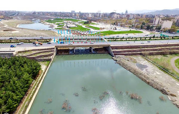
هم یک شترک و شیرحصار در نزدیکی رودخانه چهل بازه فعلی است و هم یک شترپا و شیرحصار در نزدیکی شهر جدید گلبهار و شهر باستانی توس میباشد. اگر براساس نامگذاری چهچهه در نظر بگیریم که نام رود پرآبی در شرق شهر توس می باشد و دو جا در کلات و چناران تکرار شده، میتوان پی به رودخانه پرآبی در اطراف کشفرود فعلی برد که نام این روستاها را با رودخانه کنار خود پیوند میزند.
میل ها و میل کاریز
در نزدیکی شیرحصار و شترک و رودبار چهل بازه که به کشفرود میپیوندد، میل کاریز هست. میل ها از قدیم اساسا نقش نجومی داشتند و برای تشخیص موقعیت ستاره خاصی (مثل ستاره قطبی) و یا برای تشخیص وقت خاصی از زمان استفاده میشده اند. برخی از آنها کاربرد دیگری نیز میتوانسته داشته باشند. مثل میل کاریز که علاوه بر جایگاه راهنمایی برای مسافران در محدوده شترک و رودبار چهل بازه، با کاریز در کنار نام خود اهمیت و جایگاه قنات در آن منطقه را نشان میدهد.
میلها که برج یا برج مقبره نیز نامیده میشوند، بناهایی هستند که ارتفاعشان زیاد است و در مسیر شاهراههای قدیم ساخته میشده اند تا مسافر بتواند از دور مسیرش را تشخیص دهد. سازندگان این میلها همیشه بر این نکته واقف بودند که این بناها یک جنبه راهنماگری دارد، اما این امکان نیز وجود داشت که از آن برای اهداف و کاربردهای دیگر نیز استفاده کنند. به عنوان مثال با دفن فردی در این بنا نام برج مقبره نیز بر آن نهاده شده است. میل اخنگان در نزدیکی رودخانه رضوان، که یکی از رودهای مهم و شاخه های اصلی کشفرود از سمت کارده است، از این دست برج مقبره هاست.
چرخ زندگی مردمان کنار رود با آب میچرخد و میل های متعددی که امروز در مسیر کشفرود شاهد آنها هستیم، یکی از مکان های مهم تقویمی و استهلال ماه و تشخیص آغاز فصل ها و بخصوص زمستان بوده است. علاوه بر این، با میل کاریز در آن محل به راهنمایی کاروانها در مسیر جاده ابریشم میپرداخته اند.
قلعه تاریخی میل کاریز و فاصله میل ها با هم
قدمت میل کاریز را در وقف نامه ها میتوان مشاهده کرد: در وقف نامة میرزا ابراهیم رضوی (سال ۱۰۳۸ هجری قمری) هنگام معرفی باغ عشرت آباد که وقف سادات رضوی است نوشته شده: «باغ عشرت آباد، در اندرون شهربند در محلة کاریز».
محل قلعه تاریخی میل کاریز در حاشیه شرقی میدان شهید موسوی قوچانی (محل تقاطع خیابان حر عاملی با بولوار توس) است. فاصله قلعه میل کاریز قناتی، شترک و شیرحصار محدوده مشهد تا میل اخنگان که آن نیز برجی تاریخی است ۳۰ کیلومتر میباشد. شیرحصار چناران نیز که در کنار روستای زیارتی شترپا با خاک سرخ قرار دارد فاصله ۶۰ کیلومتری تا برج تاریخی و نجومی رادکان دارد. فاصله گذاری این برجها بر حسب نیاز بوده و برای تعیین وقت دقیق اوقات تقویمی استفاده میشوند.
شیرحصار در شرقی تمرین نقطه شهرهای باستانی مهم اطراف کشفرود
کشاورزان به چله های فصلی توجه دارند. این چله ها که بعد از یک ماه و ده روز در هر فصل وجود دارند، در تقویم برنامه ریزی کشاورزی نقش دارند. در هر زمان مشخصی، کشاورز طبق برنامه به آبیاری، برداشت، آماده سازی زمین و غیره میپردازد. مثلا چله تابستان یکی از زمان های برداشت و آبیاری برای برخی محصولات است. بعلاوه، مردم که تغییرات فصلی را در نظر دارند با رسیدن هر چله فصلی برای کارهای فصل نو آماده می شوند. حتی برخی از این چله ها جشن و مراسم مخصوص درد.
شیر در فرهنگ باستان نام شرق و خورشید در صورت فلکی را دارد و میتوان به اهمیت این روستاها از نظر تقویم نجومی در تعیین دقیق زمان و مکان پی برد. خواجه نصیرالدین طوسی (597-672 هجری قمری) در حدود قرن سیزدهم میلادی و هشت قرن پیش با توجه به اهمیت و جایگاه تقویم زمانبندی، برج تقویمی رادکان را که به بزرگترین ساعت آفتابی نیز شهرت دارد در دوره هلاکو خان در نزدیکی شیرحصار ساخت (حدود 60 کیلومتر فاصله دارد).
زمانی که سخن از تقویم ستاره شناسی می آید، نام سایر مراسمات و جشن های باستانی ایرانی نیز می آید. در فرهنگ ایران باستان شب چله که کوتاهترین روز سال بوده است جایگاه خود را داشته است.
شب چله و رودخانه چهل بازه
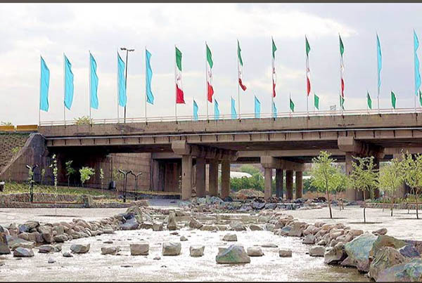
در فرهنگ باستانی ایران عدد چهل که نماد کثرت است و بعنوان عدد کمال و پایداری هم استفاده میشود، برای آب که نماد روشنی است به کار میرفته است. در مشهد به جز کال چهل بازه، آب انبار چهل پایه نیز هست که هر دو، علاوه بر قدمتی که دارند در ارتباط با آب هستند و اشاره به عدد پایداری چهل دارند که احتمالا منظور تامین آب پایدار در این مناطق بوده است. آب انبار چهل پایه نزدیک حرم رضوی است و کال چهل بازه در منطقه میل کاریز به کشفرود میپیوندد.
اگر از بالا بر نقشه محلی کال چهل بازه از سمت شیرحصار و شترک نگاه کنیم بیشتر متوجه باستانی بودن و اهمیت اجرای مراسمات و فرهنگی و اجتماعی در آن نقطه میشویم. تعداد مراسم ها و آداب و رسوم یک منطقه گواه از غنای فرهنگی یک جامعه میدهد.
مردم سناباد، آبکوه، توس و شیرحصار همگی در یک بازه چله که نشان از طولانی بودن میدهد انتظار میکشند: آنها انتظار اولین روز سال بارش برف را از نظر کشاورزی میکشیده اند و منتظر تولد فرزندی به نام زمستان بوده اند.
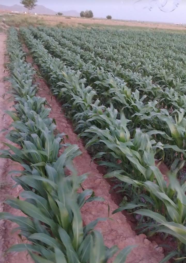
برف و یخدان های برفی در فصل زمستان برای فصل های کم بارش در این مناطق به قدری اهمیت داشته است که نام شیر، سلطان جنگل، را در کنار شتر که حیوانی با تحمل آبی بیشتر آورده اند. شیر حصار، شترک و شترپا اهمیت زیست محیطی جنگل در کنار استمرار کشاورزی پایدار را از گذشته تا به امروز برای ما یادآوری میکند. ضمن آن، به جایگاه شتر در میان کاروانهایی اشاره میکنند که مسیر طولانی سفر را بر دوش میکشیده اند.
جایگاه کشاورزی در شیرحصار
شیرحصار در کنار رودخانه چهل بازه فقط تلاقی یک روستا با قدمت بالا در کنار رودخانه چهل بازه نیست. این روستا تلاقی تقویم های کشاورزی و راهنماگونه را با جایگاه آب و آبادی نشان میدهد. هم شیرحصار نزدیک برج رادکان چناران باستانی و هم شیرحصار نزدیک میل کاریز و تلاقی کشفرود و چهل بازه باید از یک نظر حفظ شوند و آن حفظ میراث فرهنگی و باستانی آنها از نظر گردشگری و ارتباطات است.
________________________
Iranian Calendar Culture
In Iranian culture, both the lion and the number forty have a special meaning. Based on this poem in Saadi's Golestan, which says: "Clouds, wind, fog, sun, and sky are at work so that you may reap bread and not be careless," Iranians have been preserving their days with calendar symbols and poems and have been engaged in earning their lawful livelihood and sustenance. In the meantime, there is a time when it is necessary to collect water from a series of wells such as a qanat for the dry season, and a group of people come from a long journey with their guides. They all need guidance and precise timing so that they can find their way at all times. Their means of travel have often been strong animals such as camels, donkeys, or horses that can carry heavy loads.
Considering that Kashfrud was once on the Silk Road and the people along the river needed precise water distribution, where water, guidance, and camels were needed, Shtrak, Shirhesar, and Mil Kariz are the names of the villages on the healing path of Kashfrud. Similar names can be seen on the west side of Kashaf-rud, where it is called Chenaran, and this indicates a river with a lot of water, such as the Rezvan River and Checheheh around Kashafrud.
Chehelbaze River
Chehelbaze Bridge-Kashfrud
There is both a Shtrak and Shirhesar near the current Chehelbaze River, and a Shtrapa and Shirhesar near the new city of Golbahar and the ancient city of Toos. If we consider based on the naming of Checheheh that the name of the river is in the east of Toos and is repeated in two places in Kalat and Chenaran, we can trace the river with a lot of water around the current Kashfrud, which connects the names of these villages with the river next to it.
Mills and Mills of Kariz
Near Shirhesar, Shtrak, and the Chehel Baze River that joins the Kashfarud, is the Mill of Kariz. Mills have traditionally had an astronomical role and have been used to determine the position of a specific star (such as the North Star) or to determine a specific time of day. Some of them could have had other uses as well. For example, Mill of Kariz, which, in addition to being a guide for travelers in the Shtrak and Chehel Baze River areas, with Kariz next to its name indicates the importance and position of the Qanat in that area.
Mills, also called towers or tomb towers, are buildings that are very tall and were built along old highways so that travelers could recognize their route from afar. The builders of these mills were always aware that these buildings had a guiding aspect, but it was also possible to use them for other purposes and applications. For example, by burying someone in this building, it was also named the Tomb Tower. The Akhangan Mill near the Rezvan River, which is one of the important rivers and the main branches of the Kashfrud from the Kardeh side, is one of these tomb towers.
The wheel of life of the people along the river revolves with water, and the numerous mills that we see today on the Kashfrud route were one of the important places for the calendar, the new moon, and the beginning of the seasons, especially winter. In addition, the Kariz Mill was used to guide caravans on the Silk Road.
The historical castle of the Kariz Mill and the distance between the mills
The antiquity of the Kariz Mill can be seen in the endowment letters: In the endowment letter of Mirza Ebrahim Razavi (1038 AH), when introducing the Ishrat Abad Garden, which is dedicated to the Razavi Sadat, it is written: "Ishrat Abad Garden, inside Shahrband in the Kariz neighborhood."
The location of the historical castle of the Kariz Mill is on the eastern edge of Shahid Mousavi Quchani Square (the intersection of Hor Ameli Street and Toos Boulevard). The distance between the Qala Mil Kariz Qanat, Shtrak and Shir Hesar in Mashhad to Mil Akhangan, which is also a historical tower, is 30 kilometers. The Shir Hesar in Chenaran, which is located next to the pilgrimage village of Shtrak with red soil, is 60 kilometers from the historical and astronomical tower of Radkan. The spacing of these towers is according to need and is used to determine the exact time of calendar times.
Shir Hesar in the eastern part of the practice point of important ancient cities around Kashfarud
Farmers pay attention to seasonal chelles. These chelles, which exist after a month and ten days in each season, play a role in the agricultural planning calendar. At any given time, the farmer irrigates, harvests, prepares the land, etc. according to the plan. For example, the summer chelle is one of the times of harvesting and irrigation for some crops. In addition, people who consider seasonal changes prepare for the new season's work with the arrival of each seasonal chelle. Some of these chelles are even special celebrations and ceremonies.
In ancient culture, the lion is the name of the east and the sun in the constellation, and the importance of these villages in terms of the astronomical calendar in determining the exact time and place can be understood. Around the 13th century AD and eight centuries ago, considering the importance and position of the calendar, Khwaja Nasir al-Din Tusi (597-672 AH) built the Radkan calendar tower, which is also known as the largest sundial, during the reign of Hulagu Khan near Shirhesar (about 60 km away).
When it comes to the astronomical calendar, the names of other ancient Iranian ceremonies and celebrations also come up. In ancient Iranian culture, the night of Chele, which was the shortest day of the year, had its place.
The night of Chele and the Chehel Baze River
The Chehel Baze River - Vakil Abad
In ancient Iranian culture, the number forty, which is a symbol of abundance and is also used as a number of perfection and stability, is used for water, which is a symbol of light. In Mashhad, apart from Kal Chehel Baze, there is also Ab Anbar Chehel Paye, both of which, in addition to their antiquity, are related to water and refer to the number forty, which probably meant to provide stable water in these areas. Ab Anbar Chehel Paye is near the Razavi Shrine, and Kal Chehel Baze joins the Kashf Rud in the Mil Kariz area.
If you look at the local map of Kal Chehel from aboveIf we look at the period from the direction of Shirhesar and Shtrak, we will realize more about the antiquity and importance of performing cultural and social ceremonies at that point. The number of ceremonies and customs of a region is evidence of the cultural richness of a society.
The people of Sanabad, Abkuh, Toos and Shirhesar all wait in a period that indicates a long time: they have been waiting for the first day of snowfall of the year in terms of agriculture and have been waiting for the birth of a child called Winter.
Shtrakpa - planting agricultural crops in red soil
Snow and snowdrifts in the winter have been so important for the low rainfall seasons in these areas that they have brought the name of the lion, the king of the forest, along with the camel, an animal with more water tolerance. Shirhesar, Shotorak and Shtorpa remind us of the environmental importance of the forest along with the continuation of sustainable agriculture from the past to the present. In addition, they point to the place of the camel among the caravans that have carried the long journey.
The agricultural site of Shirhesar
Shirhesar on the banks of the Chehelbaze River is not just the confluence of an ancient village on the banks of the Chehelbaze River. This village represents the confluence of agricultural and guide calendars with the site of water and settlement. Both Shirhesar near the ancient Radkan Tower of Chenaran and Shirhesar near Mil Kariz and the confluence of the Kashaf-roud and Chehelbaze rivers should be preserved from one perspective, and that is to preserve their cultural and ancient heritage in terms of tourism and communication.
رودخانه چهچهه، آب انبار آن و بیوگاز
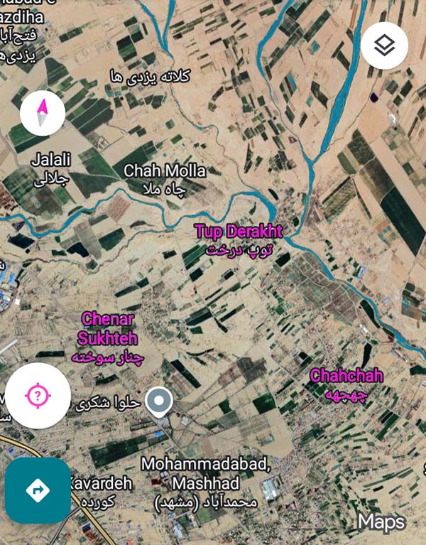
امروز که این مطالب را مینویسم زمین سفید پوش شده است. بارندگی ها افزایش یافته است تا اول دی ماه شاهد بارش برف باشیم. در گذشته بارش برف آغاز اجرای یک سری سنت ها در روستاهای بالادست برای پایین دستی ها بوده است، تا آب بتواند در همه زمان ها جاری بماند و خشکسالی ها به تاخیر بیفتد. سنت هایی مثل برفچال و نگهداری آب در کنار بهره برداری از کاریز (قنات) از آن دسته کارها به شمار میروند.
اگر نام چهچهه را جستجو بزنیم، آن را خاص استان خراسان می یابیم. در فرهنگ لغت چهچهه [ چ َ چ َ ه َ ] ( اِخ ) نام رودی است در مشرق مهنه در شمال شرقی طوس به خراسان.
هنگامی که توسعه روستایی کنار رودها را بررسی میکنیم، نامگذاری های یک دوره خاص به چشم میخورد. مثلا برای کشفرود از سمت شمال شرقی توس به چناران نامهای روستایی از چهچهه داریم تا چنارسوخته که این نامگذاری ها برای رودهای فرعی رودخانه کلات نیز تکرار شده اند:
چهچهه، چنار سوخته و سایر نامگذاری ها بر پایه آب و درخت
با یک بررسی دقیق تر و مقایسه، در می یابیم که چهچهه رود با اهمیتی بوده است که در دوران های مختلف خشکسالی و ترسالی سعی در حفظ آن داشته اند. این رود یکی از رودهای مهم کشفرود بوده است که از سمت کلات جاری میشده و یکی از شاخه های آن از سمت چهچهه کنار کشفرود به این رودخانه میپیوسته است.
چهچهه کلات که روستایی در بالادست کشفرود محسوب میشود، بیشتر جنبه باستانی خود را حفظ کرده است. آثار باستانی بیشتری نسبت به چهچهه نزدیک چناران می یابیم:
خشت نادری، مساجد و آب انبارهایی که هنوز پابرجا هستند
اهمیت جریان آب و رودخانه ها در ایران، از باستان
اهمیت چهچهه کلات بیش از چهچهه چناران بوده است. این روستا که نقش ورودی سدهای امروزی را در باستان داشته است به حفظ و نگهداری از آب انبارها میپرداخته است. حفظ آب و جاری نگه داشتن آن از کلات تا چناران وظیفه دیرینه روستایی های چهچهه کلات بعنوان منطقه ای در سرچشمه کوه های هزار مسجد بوده است. امروزه، نگهداری و ایجاد برکه را که هنوز دایر است را در اِوَز می یابیم.
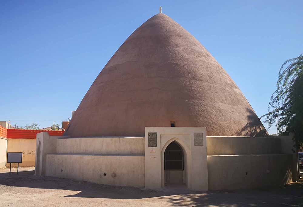
سنت برفچال مازندران گاهی هنوز پابرجاست و با رعایت سنت ها و رسیدگی به آب انبارها، آن فصل ها که بارندگی نبوده است، باران و برف را در کنار کاریز و قنات حفظ میکردند تا در نهایت رودها را جاری ببینند.
آب انبار و سدها فقط برای تامین آب آشامیدنی
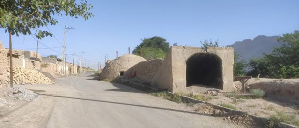
با گذشت زمان و تقسیمات جغرافیایی، آب انبار چهچهه کلات جهت تامین آب آشامیدنی روستای چهچهه تعریف شد. آب ازطریق نهر و جوی به مخزن این آب انبارهدایت و پس ازته نشین شدن رسوبات وافزودن کلربهداشتی و قابل شرب میشده تا اهالی مصرف نمایند. رعایت مسائل بهداشتی و افزودن هزینه هایی برای بهداشتی نمودن آب ها، آن را به محصولی تبدیل کرده که در زمان هایی اجازه قطع دسترسی به آن را بدهند و مانع از جاری شدن آن در مسیر حیات وحش و طبیعت شوند. آبی که برای حفظ گونه های زیست محیطی حیاتی بود، به دلیل بهداشتی شدن قطع شده و فقط در برخی موارد که کشاورزان نیاز مبرم به آن داشتند، آن را باز میکرده اند. در نتیجه این اعمال هم سنت روستای بالادست چهچهه برای حفظ و نگهداری آب در خشکسالی از بین رفته است. امروزه نگهداری آب در مخازنی با هزینه پمپاژ و برق صورت میگیرد که آب را در ارتفاع نگهداری میکنند و چون هزینه آن بالا میرود، مبالغی با کنتور خوانی از مردم میگیرند. تامین برق در مرحله اول با خود جریان آب صورت میگیرد و در زمان هایی که آب نیست از گاز استفاده میکنند و اخیرا نیز شاهد مازوت سوزی سنگین در نیروگاه سیکل ترکیبی توس هستیم.
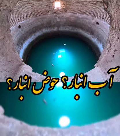
به انباری که حوض دارد چه میگویند؟
آب انبار یا برکه، حوض یا استخر سرپوشیده ای است که برای ذخیره آب معمولاً در زیرزمین ساخته می شود. نه تنها در مناطق کم آب و کویری، آب انبار را از آب باران یا جویبارهای فصلی پر میکرده اند، بلکه در جاهایی مثل مازندران سنت برفچال در زمستان داشته اند و جاهایی مثل چهچهه کلات آب را برای جاری نگه داشتن تا چهچهه چناران حفظ و نگهداری میکرده اند. این سنت تا همین اواخر و در دوره قاجار وجود داشته است.
دستگاه هاضم بیوگاز
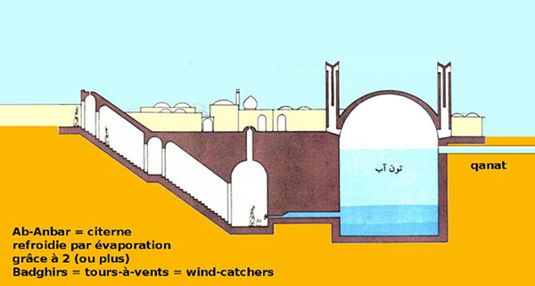
آب انبار یا همان حوض انبار که در کنار قنات استفاده میشود، من را یاد معماری دستگاه هاضمه بیوگاز انداخت که در نوع کوهستانی آن با آجر و سیمان و رس ساخته میشود. اصل وجود دستگاه هاضم بیوگاز بیشتر برای تولید کمپوست است. در کنار آن محصول فرعی تولید گاز خانگی دارند. امروزه، در تولید گاز خانگی از معماری مشابه آب انبار استفاده میشود، با یکسری تفاوت ها و جزئیات که محفظه گاز در بیوگاز تکمیل کننده آن است:
محفظه گاز
محفظه گاز محل تجمع گازهای حاصل از تخمیر مواد است. اصولاً از یک استوانه ته بسته با ورقههای فولادی به ضخامت ۱ تا ۳ میلیمتر ساخته میشود. سقف آنرا به صورت مخروطی میسازند تا هم مقدار بیشتری گاز در آن ذخیره شود و هم آب باران روی آن جمع نشود و پوسیدگی ایجاد نکند. در مرکز راس محفظه گاز یک لوله فلزی ثابت را از داخلش عبور میدهند تا پایین و بالا رفتنش در هنگام مصرف گاز یا تولید گاز کنترل شود.
اختراع نیروگاه بیوگاز ایرانی
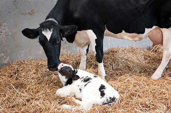
در مازندران دستگاه بیوگاز به عنوان "اولین نیروگاه بیوگاز ایرانی" توسط دو دانشجوی مخترع دانشگاه مازندران با هدف انجام پروژههای فاضلاب انسانی، جمع آوری و تبدیل آن به کود غنی کشاورزی ساخته شده است. امروزه، هند نام دستگاه بیوگاز را برای خود ثبت کرده است و آن هم به دلیل اهمیت دادن بیشتر به حفظ گاوداری ها و تهیه کمپوست برای کشاورزی در هند است.
_______________________
Chehchehe Stream - Kashafarud
Today, as I write this, the ground is covered in white. Rainfall has increased until we will see snowfall on the first day of January. In the past, snowfall was the beginning of a series of traditions in the upstream villages for the downstream ones, so that water could flow at all times and droughts could be delayed. Traditions such as snow-making and water conservation, along with the exploitation of the karez (qanat), are among those things.
If we search for the name Chechehe, we find it specific to Khorasan province. In the dictionary, Chechehe [ چ َ چ َ ه َ ] ( خ ) is the name of a river east of Mahneh, northeast of Tus in Khorasan.
When we examine the rural development along the rivers, the names of a specific period come to mind. For example, for the Kashaf-rud from the northeast of Toos to Chenaran, we have village names from Chechehe to Chenar-Sokhte, and these names have also been repeated for the tributaries of the Kalat River:
Chechehe, Chenar Sokhte, and other names based on water and trees
With a more detailed examination and comparison, we find that Chechehe was an important river that they tried to preserve during different periods of drought and wetness. This river was one of the important rivers of Kashfrud that flowed from the Kalat side, and one of its branches joined this river from the Chechehe side next to Kashfrud.
Chechehe Kalat, which is considered a village upstream of Kashfrud, has preserved most of its ancient aspect. We find more ancient monuments than Chechehe near Chenaran:
Rare bricks, mosques, and cisterns that are still standing
The importance of water flow and rivers in Iran, since ancient times
The importance of Chechehe Kalat was greater than that of Chechehe Chenaran. This village, which played the role of the entrance to today's dams in ancient times, has been concerned with preserving and maintaining water reservoirs. Preserving water and keeping it flowing from Kalat to Chenaran has been the ancient duty of the villagers of Chechehe Kalat as a region at the source of the Hezar Masjid Mountains. Today, we find the maintenance and creation of the pond that is still in operation in Evaz.
Ab Anbar-Evaz
The tradition of Mazandaran snowmen (Barfchal) is sometimes still in existence, and by observing traditions and taking care of the water reservoirs, in those seasons when there was no rainfall, they would preserve rain and snow next to the kariz and qanat to finally see the rivers flowing.
Water reservoirs and dams are only for supplying drinking water
Water reservoir and Chechehe pond
With the passage of time and geographical divisions, the Chechehe Kalat water reservoir was defined to supply drinking water to the village of Chechehe. Water was led to the reservoir through streams and rivers, and after sedimentation and chlorine addition, it became sanitary and drinkable for residents to consume. Observing health issues and adding costs to sanitize water has turned it into a product that at times allows access to it to be cut off and prevents it from flowing into the path of wildlife and nature. Water, which was vital for preserving ecological species, was cut off due to sanitation and only opened in some cases when farmers urgently needed it. As a result of these practices, the tradition of the upstream village of Chechehe to preserve and store water in drought has been lost. Today, water is stored in tanks with pumping and electricity costs that store water at a height and because its cost is rising, people are charged by meter reading. Electricity is initially supplied by the flow of water itself, and when there is no water, gas is used, and recently we have witnessed heavy fuel oil burning at the Toos combined cycle power plant.
Storage pond
What is a storage tank with a pond called?
A storage tank or pond is a covered pond or pool that is usually built in the basement to store water. Not only in areas with little water and deserts, they filled the storage tank with rainwater or seasonal streams, but in places like Mazandaran, they had a tradition of snowmelt in the winter, and places like Checheh Kalat preserved and stored water to keep it flowing to Checheh Chenaran. This tradition existed until recently, during the Qajar period.
Biogas Digester
Storage tank next to a qanat
The storage tank or the storage pond used next to a qanat reminded me of the architecture of a biogas digester, which is made of brick, cement, and clay in its mountainous form. The main purpose of a biogas digester is to produce compost. In addition, they have a by-product of producing domestic gas. Today, in the production of domestic gas, a similar architecture to the storage tank is used, with a number of differences and details that the gas chamber in biogas complements:
Gas chamber
The gas chamber is the place where gases resulting from the fermentation of materials accumulate. It is basically made of a closed-bottomed cylinder with steel sheets 1 to 3 mm thick. Its roof is made conical so that a larger amount of gas can be stored in it and rainwater does not collect on it and cause decay. At the center of the top of the gas chamber, a fixed metal pipe is passed through it to control its lowering and raising during gas consumption or gas production.
Invention of the Iranian biogas power plant
Cow and calf
In Mazandaran, the biogas plant was built as the "first Iranian biogas power plant" by two student inventors from the University of Mazandaran with the aim of carrying out human sewage projects, collecting it and converting it into rich agricultural fertilizer. Today, India has registered the name of biogas plant for itself, due to the greater importance given to maintaining dairy farms and providing compost for agriculture in India.
جنگل دهشک توس
پوشش سبز زمین از منابع و ثروتهای ارزشمند کره خاکی است که به صورت های مختلف نقش مهمی در زندگی و اقتصاد جوامع بشری ایفا کرده است. جنگل و مرتع دو اصطلاح متعارف برای نامیدن گیاهانی است که به علت زیاد اقتصادی بعنوان محصول اصلی و یا فرآوردههای فرعی لقب طلای سبز بخود گرفته اند.
ارزش فرآورده های ثانوی اغلب گیاهان در طبیعت به مراتب بیشتر از ارزش اقتصادی محصولات اصلی و مستقیم آنان است. دراین میان میتوان به انواع مختلف گونه های بلوط، گردو، زیتون، بید، بیدمشک و پسته وحشی یا همان بنه در بین درختان بومی اشاره کرد. این موضوع در خصوص هزاران گونه علفی و خوبی نظیر باریجه، آنغوزه، گون، نعناع، آویشن، شیرین بیان و غیره به مراتب بیشتر است.
به جرئت میتوان گفت که هیچ گیاهی در بین عالم خلقت وجود ندارد که فاقد خاصیت دارویی و یا ارزش بخصوص نباشد و چنانچه گیاهانی وجود دارد که هنوز خاصیتی برای آنها شناخته نیست، دلیلش را تنها در ضعف علمی و آگاهی های بشر باید جست.
در کشور ایران با دارا بودن تنوع زیستی و آب و هوایی گوناگون، بالغ بر هشت هزار گونه گیاهی با ارزش وجود دارد که واجد بسیاری از خصوصیات شناخته شده بعنوان غذا، دارو یا سایر کاربردهای صنعتی میباشند.
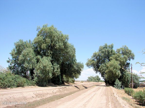
بهره برداری مستقیم از گیاهان و طبیعت جنگل به میزان زیاد و خارج از ظرفیت، سبب تخریب پوشش گیاهی در رویشگاههای طبیعی میگردد. این مورد را میتوان خصوصا در روستاهای اطراف کشفرود در مشهد و توس یافت. روستاهایی مانند کشف، و نخودک که فقط نامی از آنها باقی مانده است و دهشک، شاهراه، کلاته برفی و شمس آباد، که در توس شهرت دارند.
تداوم این امر علاوه بر تخریب اکوسیستمهای طبیعی سبب میشود تا در صورت عرضه گیاهان غیر بومی بجای بومی توسط افراد ناآگاه و احتمالا سودجو و یا توصیه به کاشت نابجای گیاهان نتوانیم آنطور که باید کشفرود را احیا کنیم و بلکه سلامت جامعه را نیز به خاطر بیندازیم.
براین مبنا به شناساندن برخی گیاهان مفید که رستنگاه آنان کناره رودخانه است میپردازیم.
طلای سبز کشفرود
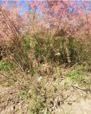
یکی از روشهای حفاظتی سواحل رودخانه استفاده از پوشش گیاهی چمنی درختچه ها، بوته زارها و درختان است. هر چه این گیاهان با ساحل سازگارتر باشند، حفاظت بهتر صورت می گیرد. از گیاهان بومی اطراف کشف رود نی گز و بید هستند. کشفرود گونه منحصر به فردی از گز دارد که مختص همین منطقه است. در کنار کشفرود روستایی با نام نیستان داریم که اشاره به نیزارهای وسیع اطراف کشفرود دارد. همچنین درخت بید، گیاهی آبدوست است که گونه های مختلف آن در اطراف کشفرود یافت میشود.
این گیاهان همچنین میتوانند به عنوان نشانگرهای زیستی در تشخیص مقادیر زیاد کادمیوم آرسنیک و منگنز به کار روند. به این صورت که در گیاه نی، برگها و ساقه مقادیر زیادتری نسبت به سایر گیاهان عنصر منگنز را خیره میکند و میتوان در آزمایشگاه این مقدار زیادتر از حد مجاز را رصد کرد و آلودگی آب از این عناصر را پاکسازی کرد، به این کار گیاه پالایی میگویند. بید نشانگر زیستی آرسنیک است، و گز نشانگر کادمیوم میباشد. آلودگی آبها توسط این عناصر توسط پژوهشگران به دقت چک می شود، چرا که این عناصر برای بدن انسان در دوزهای بالا خطرناک هستند، گرچه مقادیر صحیح آنها ضرری ندارد. با کاشت این گیاهان گز، بید و نی میتوان مازاد دوزهای این عناصر خطرناک را برداشت کرد. چون گیاه از خاکی که این عناصر در آن زیاد است به عنوان ماده اولیه مورد نیازش استفاده میکند. وقتی خاک بستر رودخانه از این عناصر پاک شود، همزمان آب نیز از آلودگی پاک میشود. به علاوه محیط زیست مناسبی برای سایر جانداران اکوسیستم فراهم میگردد.
جنگل دهشک توس
_aaje.jpg)
در مکانیابی کاشت این گیاهان بومی قبلاً در پایان نامه ای دانشگاهی به ریزآبه کارده کشفرود اشاره شده بود، ولی اکنون با توجه به ظرفیت های جدیدی که در اطراف روستا باغ های توس ایجاد گردیده است توس انتخاب میگردد. در منطقه توس انگیزه زیادی برای حفظ محیط زیست آن وجود دارد و وجود پارک های اکولوژیک و ژوراسیک موجود گواه این مطلب میباشد. روستاهایی مانند خطایان و دهشک میتوانند مقصد خوبی برای کاشت این گیاهان باشند. خصوصا اینکه در سمت غربی دهشک که رودخانه از میانه آن میگذرد با بهسازی پوشش گیاهی و احیای جنگل های آن میتوان به رونق کسب و کار روستا امید داشت. قدمت روستاهای اطراف کشف رود به دوران پارینه سنگی باز میگردد و باستان شناسان قدمت آن را تا آغاز تمدن در مصر تخمین زده اند. دهشک نیز، قدمت تاریخی و باستانی زیادی دارد و بهبود زیرساخت های آن میتواند زمینه گردشگری استان را رونق ببخشد.
_____________________
The green cover of the earth is one of the valuable resources and wealth of the planet that has played an important role in the life and economy of human societies in various ways. Forest and pasture are two common terms for naming plants that have been called green gold due to their high economic value as main products or by-products.
The value of secondary products of most plants in nature is far greater than the economic value of their main and direct products. Among these, we can mention various types of oak, walnut, olive, willow, wild pistachio or the same as the boletus among native trees. This is much more the case with thousands of herbaceous and good species such as barijeh, angoze, arum, mint, thyme, licorice, etc.
It can be said with confidence that there is no plant in the world of creation that does not have medicinal properties or special value, and if there are plants for which no properties are yet known, the reason should be sought only in the weakness of science and human awareness.
In Iran, with its diverse biodiversity and climate, there are over eight thousand valuable plant species that have many known properties as food, medicine or other industrial applications.
Gaz- a plant on the shore
Direct exploitation of plants and forest nature in large quantities and beyond capacity causes the destruction of vegetation in natural habitats. This can be found especially in the villages around Kashfrud in Mashhad and Toos. Villages such as Kashf, and Nakhodak, of which only their names remain, and Dehshak, Shahrah, Kalateh Barfi and Shams Abad, which are famous in Toos.
The continuation of this, in addition to the destruction of natural ecosystems, will cause us to be unable to restore Kashfrud as we should, and we will also have to consider the health of the community.
Based on this, we will introduce some useful plants that grow on the banks of the river.
Green Gold of Kashafrud
Gaz - When Flowering
One of the methods of protecting the river banks is to use grass vegetation, shrubs, bushes and trees. The more compatible these plants are with the bank, the better the protection will be. Native plants around Kashfarud include reeds, gaz and willow. Kashaf-rud has a unique species of gaz that is specific to this region. Next to Kashfarud, we have a village called Neyestan, which refers to the vast reeds around Kashaf-roud. Also, the willow tree is a water-loving plant whose different species are found around Kashfarud.
These plants can also be used as biomarkers in detecting high levels of cadmium, arsenic and manganese. In the case of the reed plant, the leaves and stems absorb higher levels of manganese than other plants, and this amount can be monitored in the laboratory above the permissible limit and water pollution from these elements can be cleaned, this work is called phytoremediation. Willow is a biomarker of arsenic, and gaz is a cadmium indicator. Water pollution by these elements is carefully checked by researchers, because these elements are dangerous to the human body in high doses, although their correct amounts are not harmful. By planting these plants, gazania, willow, and reed, excess doses of these dangerous elements can be harvested. Because the plant uses soil rich in these elements as the raw material it needs. When the soil of the riverbed is cleaned of these elements, the water is also cleaned of pollution at the same time. In addition, a suitable environment is provided for other organisms in the ecosystem.
Dehshak Toos Forest
In locating the planting of these native plants, the Kashfarud tributary was previously mentioned in an academic thesis, but now Toos has been selected due to the new capacities that have been created around the Tous Gardens village. There is a great motivation in the Toos region to preserve its environment, and the existence of ecological and Jurassic parks is evidence of this. Villages such as Khatayan and Deheshk can be a good destination for planting these plants. Especially on the western side of Dehshak, where the river flows through, by improving the vegetation and restoring its forests, one can hope for the prosperity of the village's business. The villages around Kashf-e Rud date back to the Paleolithic era, and archaeologists have estimated its age to the beginning of civilization in Egypt. Dehoshak also has a long history and antiquity, and improving its infrastructure can boost the province's tourism sector.
منطقه حفاظت شده کدوحلوایی
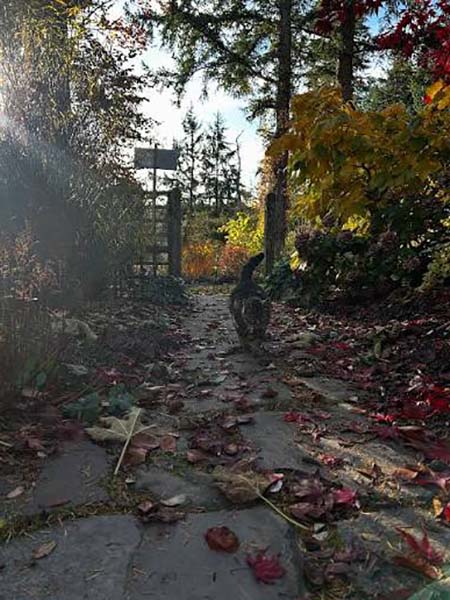
امروزه رودخانه ها، این گنجینه های بی نهایت گرانبها، به دلیل خشکسالی های پی در پی شکننده شده اند و ناپایداری تغییرات اقلیمی آنها را بیش از پیش آسیب پذیر کرده است.
افزایش دمای زمین باعث تغییر در بسیاری از جنبههای زیستی گونهها مثل فنولوژی، فیزیولوژی، ریختشناسی، چرخه جمعیتی و پراکنش گونهها شده است. پیشبینی میشود تغییرات اقلیم بیشترین تاثیر را روی گونههای دارای پراکنش جغرافیایی کم، گونههای کوهستانی و گونههای بومی بگذارد. فنولوژی شامل رخدادهای زیستی دورهای یا سیکلی در گیاهان و جانوران میباشد که متاثر است از شرایط محیطی به ویژه تغییرات دمایی ناشی از شرایط هوا و اقلیم. برخی از این رخدادهای زیستی عبارتند از جوانه زنی و گلدهی گیاهان در بهار، تغییرات رنگ برگها در پاییز، مهاجرت و لانهسازی پرندگان و حشرات و خواب زمستانی آنها. این ها هنگام تغییر اقلیم دستخوش تغییراتی میشوند، و اگر گونه نتواند خود را با تغییرات سازگار کند، امکان انقراض آن وجود دارد.
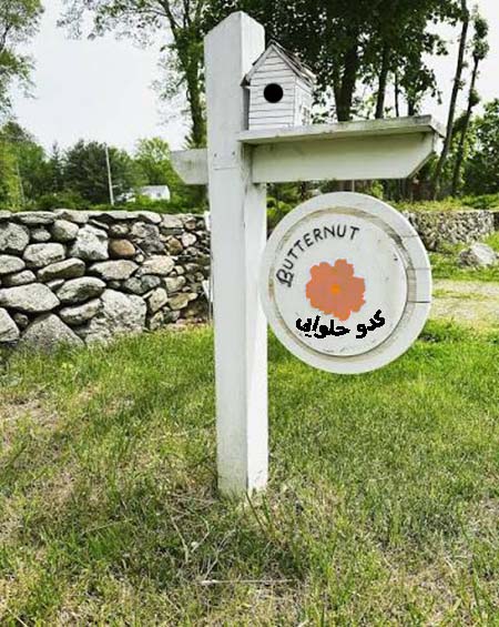
جلب مشارکت جوامع محلی در برنامههای حفاظت از حیات وحش و آموزش آنان در مورد اهمیت حفظ تنوع زیستی میتواند تأثیر مثبتی داشته باشد. ایجاد کریدور یا راهروهای ارتباط اکولوژیک بر کاهش اثرات تغییرات اقلیمی موثر است. زیستگاه گونههای حیات وحش محدود شده است ولی از طریق کریدورها میتوانند جابجا شوند. از سوی دیگر وقتی یک گروه بومی بر اثر تغییرات اقلیمی آسیب میبیند، ورود گونه غیربومی میتواند ضربه نهایی را به آن وارد کند. اگر گونههای غیربومی وارد نشود، اثر مخرب گونههای آنهایی که مانند راکون، انواع ماهیها، خزندگان مثل پیتون و لاکپشت پشت گوش قرمز شناخته شده اند، کاهش مییابد.
هر بار که محیط زیست بطور کلی مورد تهاجم قرار میگیرد، زیست بوم های اکولوژیک و آثار باستانی موجود در آنها و کناره رودخانه ها آسیب بیشتری میبینند. آنها نیازمند مراقبت بیشتری هستند. بعنوان مثال، ریزآبه های کشفرود در منطقه کلاته برفی چند سالیست که مورد غفلت قرار گرفته است و نیازمند توجه بیشتری از سمت مسئولین و ساکنین منطقه است.
کشف رود، این رود باستانی حماسه ساز نیز در پی این بی توجهی مسیرش در همین منطقه و روستای دهشک کمرنگ شده و باید احیا و بازسازی شود.
پارک های طبیعی نیز آسیب پذیرند
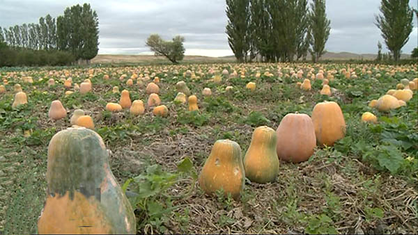
دادن چند امتیازی به طراحان جاده های وسیع اتومبیل رو و یا به شکارچیان حرفه ای و بانیان هتل های زنجیره ای برای نابودی پارکهای طبیعی کافیست. حفاظت از این گنجینه های زیست بومی کم کم به صورت یک وظیفه دائم در می آیند و کشورهای عضو میراث کنوانسیون میراث جهانی این وظیفه را به طور موثری انجام میدهند. ما بر آن هستیم که با ارائه راهکار عملی افکار عمومی را تقویت کنیم تا بتوانیم از آب و خاک خود بعنوان اموال غیرمنقول حفاظت کنیم.
منطقه حفاظت شده کدوحلوایی
یکی از این راهکارها به ایجاد کریدورهای زیستی، تعریف چند منطقه حفاظت شده به نام منطقه حفاظت شده کدو حلوایی به منظور ارج نهادن بر این میوه با برکت و مزارع آن است که مناسب انسان و دام هستند. منطقه حفاظت شده کدوحلوایی از نظر طرح در ایران قدمت چندانی ندارد. رودخانه ها و ریزآبه ها هدف نهایی طرح هستند. این طرح اگر رعایت شود به تلاش برای حفظ بیشتر اکولوژی رودخانه ها منجر میشود.
صدماتی که بر طبیعت وارد می آید بسیار سنگین است. از آنجمله میتوان به نابودی جنگل ها، فرسایش و تخریب خاک، از میان رفتن انواع گیاهان و جانوران، آلودگی آب و هوا، خشکی ها و دریاها، افزایش محلات کثیف و گسترش آسفالت و کاهش فضای سبز اشاره کرد. با این حال پیام ساده است. نمونه های زیادی از بهره بردن از منابع طبیعی داریم که ضمن مکانیسمی، منابع مورد استفاده را به خاطر نمی اندازند. از آنجمله میتوان به نمونه موفق پارک جنگلی کوهسار اشاره کرد که چشم انداز زیبایی را در حد بضاعت به وجود آورده اند.
امروز میتوان آن را با تصاویر ماهواره ای از بالا نظاره گر باشیم و امید داشته باشیم روزی آنچه بعنوان ریزآبه های کشفرود، دریاچه مانند شده، حفاظت میشوند و مسیری برای انتقال آب به مسیر اصلی رود میشوند. از سویی دیگر، با کاشت درختان زیستگاه پرندگان را تضمین میکنیم و به پایداری و تثبیت رطوبت هوا میپردازیم.
با تعریف چند مورد از این مناطق در جاهایی که قطب کدوحلوایی کشور هستند مثل روستای بیار خراسان شمالی، روستای قازانلو آذربایجان شرقی و منطقه فیروزآباد سیستان و بلوچستان که از آنها نیز رودهایی میگذرد، تلاش کشاورزان زحمت کش را ارج مینهیم و امیدواریم این میراث گرانبها، آب، بیش از پیش پاسداری شود و آرزو میکنیم در آینده نه چندان دور این مناطق با درختانی متراکم منظره هایی را بسازند و به تعداد این مکان ها افزوده شود.
________________
Wildlife Conservation
Today, rivers, these invaluable treasures, are becoming increasingly fragile due to repeated droughts, and the instability of climate change has made them even more vulnerable.
Rising global temperatures have caused changes in many aspects of the biology of species, such as phenology, physiology, morphology, population cycles, and species distribution. Climate change is expected to have the greatest impact on species with a small geographical distribution, mountain species, and endemic species. Phenology includes periodic or cyclical biological events in plants and animals that are affected by environmental conditions, especially temperature changes caused by weather and climate conditions. Some of these biological events include the germination and flowering of plants in spring, the color changes of leaves in autumn, the migration and nesting of birds and insects, and their hibernation. These undergo changes when the climate changes, and if the species cannot adapt to the changes, its extinction is possible.
Pumpkin Preserve
Involving local communities in wildlife conservation programs and educating them about the importance of preserving biodiversity can have a positive impact. Creating ecological corridors or pathways can help mitigate the effects of climate change. Wildlife species have limited habitats, but they can move through corridors. On the other hand, when a native group is being harmed by climate change, the introduction of a non-native species can be the final blow. If non-native species are not introduced, the destructive impact of species that are known to exist, such as raccoons, fish species, reptiles such as pythons and red-eared slider turtles, will be reduced.
Whenever the environment is invaded in general, the ecological habitats and the ancient monuments in them and along the riverbanks are more damaged. They need more care. For example, the Kashafrud tributaries in the Kalateh Barfi region have been neglected for several years and require more attention from the authorities and residents of the region.
Kashfrud, this ancient epic river, has also lost its course in the same region and the village of Deheshk due to this neglect and needs to be restored and reconstructed.
Natural parks are also vulnerable
Pumpkin Farm
Giving a few points to the designers of wide highways or to professional hunters and founders of chain hotels is enough to destroy natural parks. The protection of these ecological treasures is gradually becoming a permanent task, and the countries that are members of the World Heritage Convention are carrying out this task effectively. We aim to strengthen public opinion by providing practical solutions so that we can protect our water and soil as immovable property.
Pumpkin Protected Area
One of these solutions is to create biological corridors, define several protected areas called Pumpkin Protected Area in order to honor this blessed fruit and its fields that are suitable for humans and livestock. Pumpkin Protected Area is not very old in terms of planning in Iran. Rivers and its tributaries are the ultimate goal of the plan. If this plan is followed, it will lead to efforts to further preserve the ecology of rivers.
The damage that is done to nature is very heavy. Among them are the destruction of forests, erosion and soil destruction, the disappearance of various plants and animals, pollution of water, air, land and sea, the increase in dirty neighborhoods and the spread of asphalt and the reduction of green space. However, the message is simple. We have many examples of using natural resources that, while being a mechanism, do not remember the resources used. Among them, we can mention the successful example of Kohsar Forest Park, which has created a beautiful landscape within the limits of its means.
Today, we can observe it from above with satellite images and hope that one day what are known as the small streams of the Kashfarud, which have become lake-like, will be protected and become a path for transferring water to the main river. On the other hand, by planting trees, we guarantee the habitat of birds and stabilize and stabilize the humidity of the air.
By defining a few of these areas in places that are the pumpkin hub of the country, such as the village of Biar in North Khorasan, the village of Kazanlu in East Azerbaijan, and the Firuzabad region of Sistan and Baluchestan, which also have rivers flowing through them, we honor the efforts of hardworking farmers and hope that this precious heritage, water, will be protected more than ever and we hope that in the not too distant future, these areas will create landscapes with dense trees and the number of these places will increase.