Kashafrud river - رودخانه کشف رود
اینجا درباره رودخانه کشفرود ایران مینویسمKashafrud river - رودخانه کشف رود
اینجا درباره رودخانه کشفرود ایران مینویسمدرباره من
 از اونهام که می گم آدم بایست حرف خودشو بزنه، اما یاد گرفتم که هر حرفی رو تو جاش بزنم، اینجا، هرچی می خوام رو می گم
ادامه...
از اونهام که می گم آدم بایست حرف خودشو بزنه، اما یاد گرفتم که هر حرفی رو تو جاش بزنم، اینجا، هرچی می خوام رو می گم
ادامه...
حکایت روستای لقمانی باشریک
چند سال پیش برای مدتی به روستای خروسی اهواز (محله آخر آسفالت)1 کنار رودخانه کارون رفته بودم. آنجا برای خرید شیر به خانه یکی از همسایه ها رفتیم. آن روز با نحوه بازاریابی و خرید و فروش شیر در روستاهای ایران آشنا شدم. در نواحی روستایی، بسیاری از خانوارها یک گاو برای تامین شیر خود و یا فروش غیررسمی آن به همسایه ها دارند، یا شیر را از کشاورز محلی میخرند. تا همین چند وقت پیش، در مشهد و شاید حتی الآن، در روستاها شیر محلی را تا خود خانه ها حمل میکردند و همانجا کسی که شیر میخواست ظرفی داشت که با آن شیر میگرفت.
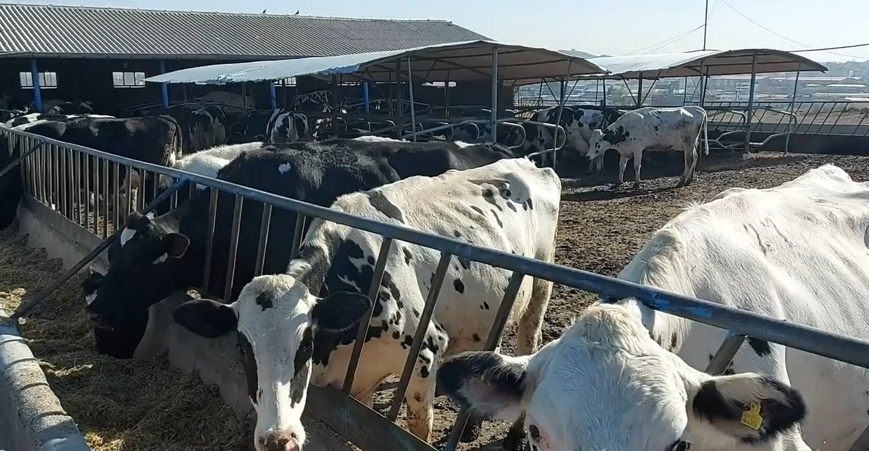
اگر امکانات سردکننده و مجوزهای قانونی بهداشتی نیز وجود داشته باشد، شیر خام در فروشگاه های محلی نیز یافت میشود. در برخی کشورها اتحادیه لبنیات دارند که به ایجاد امکانات سردکننده در نواحی دور دست مناطق روستایی کمک میکند. اتحادیه خرید شیر را تضمین میکند و به روستایی ها نیز کمک میکند شیر را در محل خود بفروشند. در ایران هم همینطور است؛ اتحادیه تعاونی های لبنی پاستوریزه، و انجمن صنایع فرآورده های لبنی دارد.
از جهت ثبات اقتصادی، روستای باشریک لقمانی، واقع در توس و در کنار رودخانه های کشفرود و رضوان وضعیت مناسبی دارد. چرا که از یک طرف به امکانات انبارداری غلات دسترسی دارد و از یک طرف هم به محل توزیع و عرضه علوفه های دامی و لبنیاتی ها در مسیر بلوار توس.
من یک بررسی روی نقشه داشتم و دیدم که بازار پرنده های زینتی نیز اخیرا به بلوار توس اضافه شده و این بازار به روستای باشریک لقمانی نیز نزدیک تر شده است.
در بازار بلوار توس انبارهای نگهداری غلات در دسترس است. اینکه علوفه های دامی در مزرعه نگهداری شوند، یا در سیلوها از نکات عرضه و تقاضا در این بازار است. نکته بعدی حمل و نقل شیر تازه است. در حالیکه تانکرهای حمل شیر یخ زده از مزرعه به کارخانه که مسیر زیادی نیست، بزرگتر میشوند، اما مهمترین عامل محدود کننده زیرساخت های جاده ای است.
روستای لقمانی باشریک یک گاوداری دارد که با جمعیت روز افزون خود بتواند نیازش را به لبنیات محلی برطرف کند. دام و علوفه نیز مساله بعدی این روستاست.
__________________
1- محله آخر آسفالت تا چند سال پیش جزو اراضی کشاورزی محسوب میشده است. قدیم تقریبا همه محله های اهواز گاو داشتند و گاومیش های اهوازی در کنار رودخانه شهرت زیادی داشتند، طوریکه یک محله در اهواز به نام گاومیش آباد داریم.
_______________________
A few years ago, I went to Khorosi village in Ahvaz (the last neighborhood of asphalt)1 by the Karun River for a while. There, we went to a neighbor’s house to buy milk. That day, I learned about the marketing and buying and selling of milk in Iranian villages. In rural areas, many households have a cow to provide their own milk or sell it informally to neighbors, or buy milk from a local farmer. Until recently, in Mashhad and perhaps even now, in villages, local milk was carried to the houses, and there, anyone who wanted milk had a container to drink it from.
Dairy farming
If there are cooling facilities and legal health permits, raw milk can also be found in local stores. In some countries, they have dairy unions that help establish cooling facilities in remote rural areas. The union guarantees the purchase of milk and also helps villagers sell milk locally. It is the same in Iran; it has a pasteurized dairy cooperatives union, and a dairy products industry association.
In terms of economic stability, the village of Basharik Loghmani, located in Toos and along the Kashafrud and Rezvan rivers, has no problem. Because on the one hand, it has access to grain storage facilities and on the other hand, it has access to the distribution and supply of livestock fodder and dairy products on Toos Boulevard.
I had a look at the map and saw that the ornamental bird market has also recently been added to Toos Boulevard and this market has also become closer to the village of Bashrik Loghmani.
Grain storage warehouses are available in the Toos Boulevard market. Whether livestock fodder is stored on the farm or in silos is a supply and demand issue in this market. The next issue is the transportation of fresh milk. While the tankers carrying frozen milk from the farm to the factory, which is not a long distance, are getting bigger, the most important limiting factor is the road infrastructure.
The village of Loghmani Bashrik has a dairy farm that can meet its need for local dairy products with its growing population. Livestock and fodder are also the next issue for this village.
__________________
1- The last neighborhood of the asphalt was considered agricultural land until a few years ago. In the past, almost all neighborhoods in Ahvaz had cows, and the Ahwazi buffaloes were very famous along the river, as we have a neighborhood in Ahvaz called Gawmish Abad.
آبشار آبقد
آبشار آبقد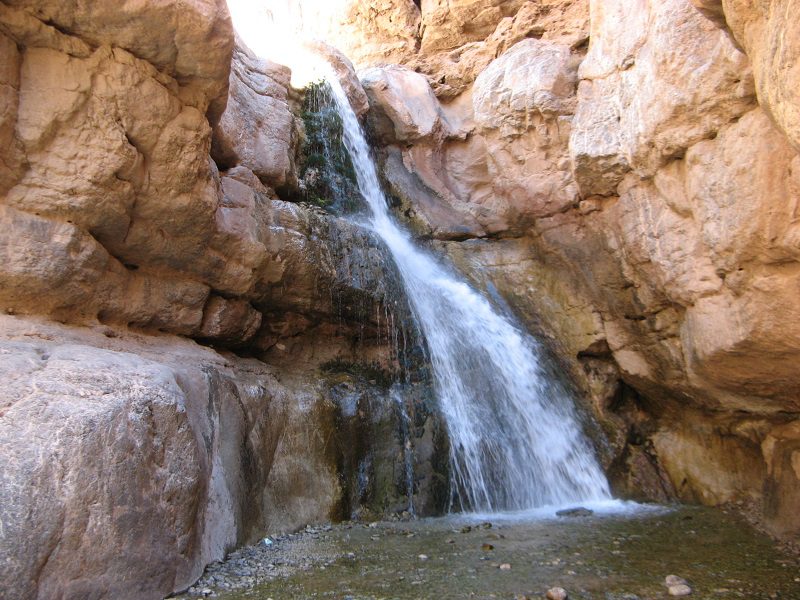
دلایل نامگذاری آبشار آبقد مشهد این ست که آبقد از دو کلمه آب و قد تشکیل شده است. این نامگذاری به دلیل فراوانی آب و چشمه ای که آبشار از آن سیراب میشود، می باشد. منظور از قد، آبی است که به اندازه قد انسان میشود و خبر از فراوانی نعمتی گرانبها می دهد. در گذشته شکارچیان و طبیعت گردان از کلمه قد به عنوان مقیاس زیاد استفاده میکردند. مثلا قرار میگذاشتند که ستاره پروین (ستاره هفت برادران) یک قد که بالا آمد حرکت کنند.

در اطراف روستاهای بینالود و یا هزارمسجد (سرچشمه کشفرود) چون محیط کوهستانی و صخره ایست، ستاره پروین نشان خوبی برای مسیریابی و آدرس دهی بوده است. آن زمان ساعت مچی کم بود و زیاد هم رسم نبود استفاده کنند. مثلا قرار میگذاشتند سستار (سه ستاره که در یک ردیف طلوع کند) که زد، یعنی یک قد یا دو قد ارتفاع گرفت، فلان تپه و گردنه باشند. هنگام گم شدن هم از دب اکبر و دب اصغر و ستاره قطبی استفاده میکرده اند.
آبشار آبقد مشهد در استان خراسان رضوی واقع است که پس از طی کردن سه کیلومتر در دره آبقد، دهنه اصلی قرار دارد که از عرض دره کاسته شده و باغها به اتمام میرسند.
مسیر دسترسی
معمولا اتوبوسهای توریستی در ابتدای جاده آبقد (آبغد) میایستند و از آنجا به بعد ماجراجویی شما در روستا و آبشار آبقد شروع خواهد شد. مسیری که پیشرویتان است، ماشین رو و شوسه است و دیگر از جاده آسفالته خبری نیست. کمی که جلوتر بروید خانههای کاهگلی روستا را در ارتفاعات میبینید. فاصله جاده آسفالته تا اول روستا حدود یک کیلومتر است. خانههای روستای آبقد تا حدودی شبیه به روستاهای پلکانی مثل کنگ بینالود و ماسوله گیلان است. در نتیجه تصویر زیبایی از آن از دوردستها بهچشم میخورد.
روستای آبقد
روستای آبقد موقعیت کوهپایه ای دارد و در فصل تابستان آب و هوای خوبی دارد. روستای آبقد خراسان رضوی جمعیتی حدود 500 نفر دارد که شغل اکثر آنها زراعت، باغداری، دامداری و کارگری در معدن می باشد. روستای آبقد مشهد مقدس دارای جاذبه های طبیعی بسیار زیباییست که شما را شگفت زده می کند.
____________________
Abqad Waterfall - Golbahar
The reason for naming the Abqad Waterfall in Mashhad is that Abqad is composed of two words: water and height. This name is due to the abundance of water and the spring from which the waterfall is watered. Height means water that is as tall as a person's height and indicates the abundance of a precious blessing. In the past, hunters and nature lovers used the word height as a measure of greatness. For example, they would set the Parvin Star (the Star of the Seven Brothers) to move when it rose one height. Around the villages of Binalod or Hezarmasjid (the source of the Kashfarud River), because the environment is mountainous and rocky, the Parvin Star was a good sign for navigation and addressing. At that time, wristwatches were rare and it was not customary to use them. For example, they would set the Sastar (three stars that rise in a row) to rise, meaning it rose one or two heights, to such and such a hill or pass. When they got lost, they used the Big Dipper, the Little Dipper, and the North Star.
The beautiful mountain of Abqad Waterfall
The Abqad Waterfall of Mashhad is located in Khorasan Razavi Province. After traveling three kilometers in the Abqad Valley, the main mouth is located, which reduces the width of the valley and the gardens end.
Access route
Tourist buses usually stop at the beginning of the Abqad (Abghad) road, and from there your adventure in the village and the Abqad Waterfall will begin. The path ahead of you is a dirt road and there is no asphalt road. If you go a little further, you will see the thatched houses of the village on the heights. The distance from the asphalt road to the beginning of the village is about one kilometer. The houses of the Abqad village are somewhat similar to terraced villages such as Kang Binalood and Masouleh in Gilan. As a result, a beautiful image of it is visible from afar.
Abqad Village
Abqad Village has a foothill location and has good weather in the summer. Abqad Village of Khorasan Razavi has a population of about 500 people, most of whom are engaged in agriculture, gardening, animal husbandry and mining. Abqad Village of the holy Mashhad has very beautiful natural attractions that will amaze you.
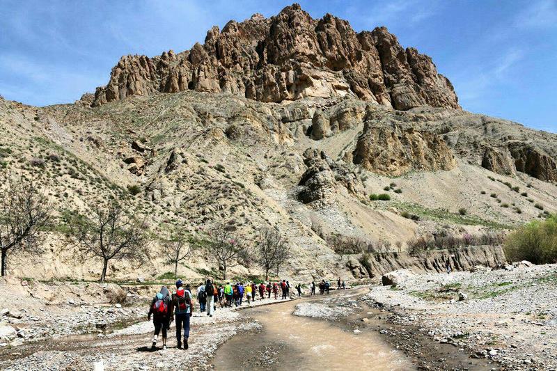
تور زشک - قسمت یک
امین محمد رازی در کتاب هفت اقلیم می گوید: مشهد مقدس منقسم به 12 بلوک است که یکی از آن جاغرق است و ارغوان دره که جای بدان لطافت و شگرفی در تمام خراسان1 نیست. همچنین، قدمت شاندیز که یکی از آثار آن قلعه باستانی شاهان دژ (کهن دژ) بوده، به پیش از اسلام میرسد. شاندیز در اصل شاهان دژ، یعنی قلعه منسوب به شاهان بوده است که در کتاب افسانه قاجار نیز آمده است. براساس روایت تاریخی، شاهان دژ در سال 1265 هجری به توپ بسته شده است.
امروزه طرقبه-شاندیز شهرستان معروفی در بین گردشگران است که روستای زشک آن شهرت جهانی دارد. این روستا که در مسیر کشفرود قرار دارد، به سبب رودهای جاری و باغ های پونه و تمشک، شهرت پیدا کرده است.
از سمت بزرگراه پیامبر اعظم روستای زشک، سمت کوه های بینالود می افتد که این مزیت آن بر شهر باستانی توس است که آن سمت دیگر بزرگراه واقع شده است. این روستا در جنوب شرقی رشته کوه بینالود در سرچشمه دره شاندیز است و دارای چشم انداز زیبا و آب و هوای معتدل و باغهای میوه، یکی از مناطق ییلاقی مشهد است. از مزایای این روستا مسیر خاص کوهنوردی است و همچنین مکانی برای تفریح ورزشی است.
دیروز که با تور گردشگری به این روستا سفر کردیم، با وجود ییلاقات و سرچشمه های جاری، کم آبی در آن به وضوح به چشم میخورد. اگرچه این روستا مسیر کوهنوردی است و در میانه مسیر رودخانه سنگهای میکای آن چشم نواز است، ولی نمی توان منکر آن شد که اگر در شهر توس باران نبوده، اینجا هم باران نیامده است.
یک عکس از گوشه ای از مسیر میگذارم که نشان میدهد خاک شور شده و طوری تخریب شده که نیاز به کود دهی دارد:
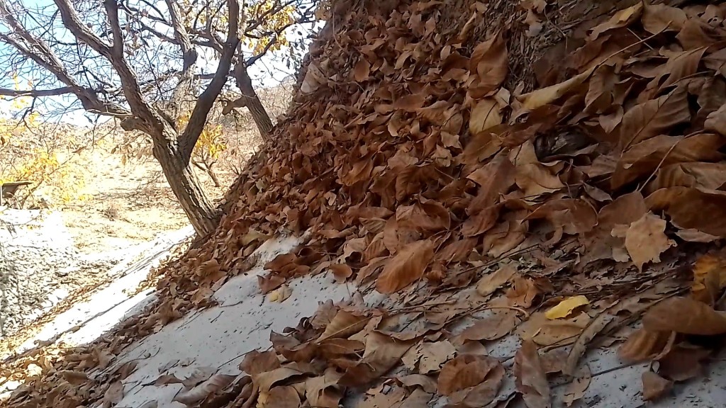
تصویر گوشه ای از یک کوه در روستای زشک را نشان میدهد. برگ ها کاملا آن را پوشانده است و به دلیل سرمای حاکم انتظار داریم آن زیر که سفید به نظر میرسد برف باشد، ولی برف نیست بلکه خاک سیلتی است.
تصویر نمونه خاک ها را ببینید:
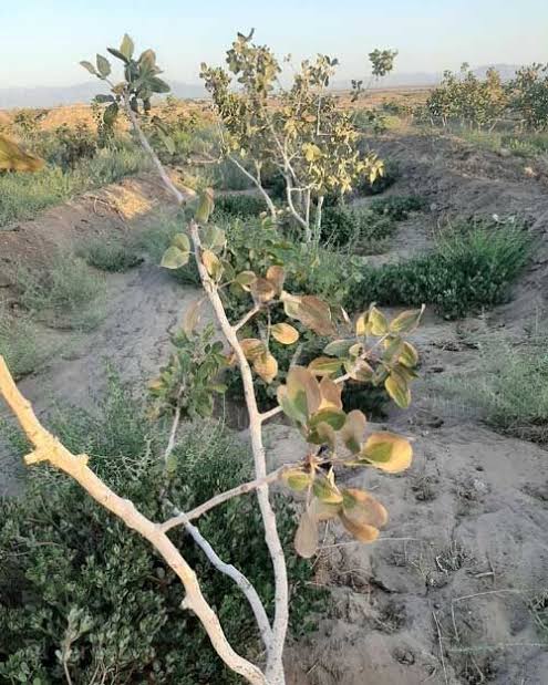
در هر دو تصویر بالا خاک مناسب کاشت نبوده و درختها ضعیف و مستعد بیماری ها هستند و گرفتار حشراتی مثل کرم ساقه خوار میشوند و در نهایت خشک میشوند. با یک بارش، سیلاب جاری میشود و آب صاف و زلالی روانه رودخانه نمیشود.
در تصویر زیر چند نمونه خاک کود دهی را مشاهده میکنید:
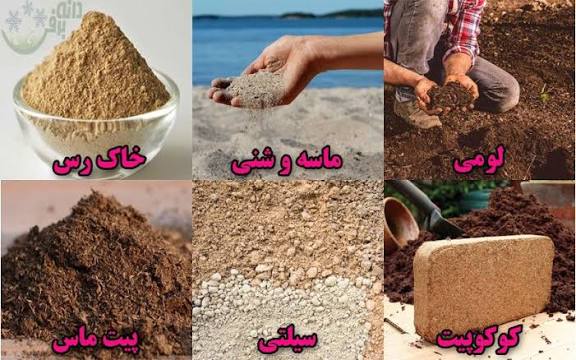
در تصویر بالا انواع خاک لومی، کوکوپیت، پیت ماس، سلیتی، خاک رس و ماسه و شنی را مشاهده میکنید. خاک مناسب برای کشاورزی و رشد و تغذیه اغلب گیاهان و درختان شامل حجم بیشتری کوکوپیت، لومی، و پیت ماس است. در تغذیه برخی گیاهان مثل زعفران، نسبت خاک رس بیشتر است. ماسه بادی هم برای کشت اولیه نهال ها استفاده میشود.
_________________
1- منظور از خراسان، همه خراسان های رضوی، شمالی و جنوبی است.
_________________________________
Amin Mohammad Razi says in the book Haft Aqlim (Seven Climate) : The holy Mashhad is divided into 12 blocks, one of which is submerged, and the purple of the valley, which has no place for its tenderness and wonder in all of Khorasan1. Also, the history of Shandiz, one of whose monuments was the ancient castle of Shahan Dej, dates back to before Islam. Shandiz was originally Shahan Dej, meaning a castle attributed to the kings, which is also mentioned in the book Afsaneh Qajar (Legend of Ghajar). According to historical narration, Shahan Dej was bombed in 1265 AH.
Today, Torqeba-Shandiz is a famous city among tourists, and its village of Zoshk is world famous. This village, which is located on the route of Kashafarud, has become famous for its flowing rivers and orchards of mint and raspberries.
From the direction of the Great Prophet Highway, the village of Zoshk faces the Binalud Mountains, which is its advantage over the ancient city of Toos, which is located on the other side of the highway. This village is located in the southeast of the Binalood mountain range at the source of the Shandiz Valley and has a beautiful landscape, a temperate climate, and fruit orchards. It is one of the summer areas of Mashhad. One of the advantages of this village is its special hiking trail and it is also a place for sports recreation.
Yesterday, when we traveled to this village on a tourist tour, despite the hiking trails and flowing springs, the water shortage was clearly visible. Although this village is a hiking trail and in the middle of the river path, its mica rocks are eye-catching, but it cannot be denied that if it has not rained in Tus city, it has not rained here either.
I will post a photo of a corner of the trail that shows that the soil has become salty and degraded to the point that it needs fertilization:
The photo shows a corner of a mountain in the village of Zoshk. Leaves have completely covered it, and due to the prevailing cold, we expect that what appears white underneath is snow, but it is not snow, but silty soil.
See sample soil images:
Saline soil - the leaves in the image are as dry as a needle
In both images above, the soil is not suitable for planting and the trees are weak and susceptible to diseases and are affected by stem-eating insects and eventually dry up. With a single rainfall, floods occur and clear water does not flow into the river.
In the image below, you can see some examples of fertilizing soil:
Types of loam, cocopeat, peat moss, silt, etc.
In the image above, you can see types of loam, cocopeat, peat moss, silt, clay, sand and sand. Soil suitable for agriculture and the growth and nutrition of most plants and trees contains a larger volume of cocopeat, loam, and peat moss. In the nutrition of some plants such as saffron, the proportion of clay is higher. Wind sand is also used for the initial cultivation of seedlings.
_________________
1- Khorasan refers to all of Razavi, Northern and Southern Khorasan.
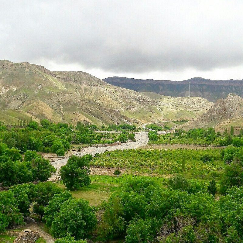
جاذبه های دیدنی پل فردوسی کشفرود
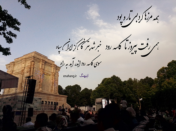
«همه مرزها کرد بیتار و پود. همی رفت پیروز تا کاسهرود. بدان مرز لشکر فرود آورید. زمین گشت زان خیمهها ناپدید. خبر شد بترکان کز ایران سپاه. سوی کاسه رود اندر آمد به راه»
«فردوسی»
محله چهاربرج با فاصله از الماس شرق که در نزدیکی خین عرب قرار دارد، هر دو در مسیر کشفرود قرار دارند. الماس شرق، از نظر ساخت مدرن و به روز محسوب میشود و محله چهاربرج، بخش تاریخی شهر مشهد است.
محله چهاربرج، جایی برای زیستن
محله چهاربرج، زمانی با عنوان روستای چهار برج شهر باستانی توس شناخته میشده است. از دیرباز، توت خشک آن در کنار قیسی، هنگامی که کشفرود در مسیر جاده ابریشم شناخته میشده، شهرت جهانی داشته است.
_1ocw.jpg)
محوطه 360 هکتاری شهر توس در فهرست آثار ملی ایران به ثبت رسیده است. موزه آرامگاه فردسی آن متشکل از چهار قسمت شامل قطعات سفالی دوره اسلام و قبل از آن، سکه های طلا و نقره دوره اسلامی، و آثار کشف شده شهر باستانی توس است.
_506j.jpg)
آثار باستانی این منطقه، مخصوصا کهن دژ، پس از چند صد سال هنوز به جای مانده است. در کنار این محوطه روستاهای بزرگی جمع شده اند که باغات آنها در کنار کشفرود از اهمیت بالایی برخوردارند. در کنار این محوطه بازاری شکل گرفته است که در آن ها محصولات باغی و روستایی به فروش میرسد. در روستاهای اطراف روی تولید صنایع مرتبط با گریپ فروت، نارنگی (پرک پرتقال، پرک نارنگی)، روغن، پوست پرتقال، پوره سیب، پوره کیوی، پوره هلو و رب گوجه فرنگی به صورت فله ای فعالیت می کنند که خصوصا در بازار میوه و تره بار از سمت آرامگاه فردوسی دیده میشوند.
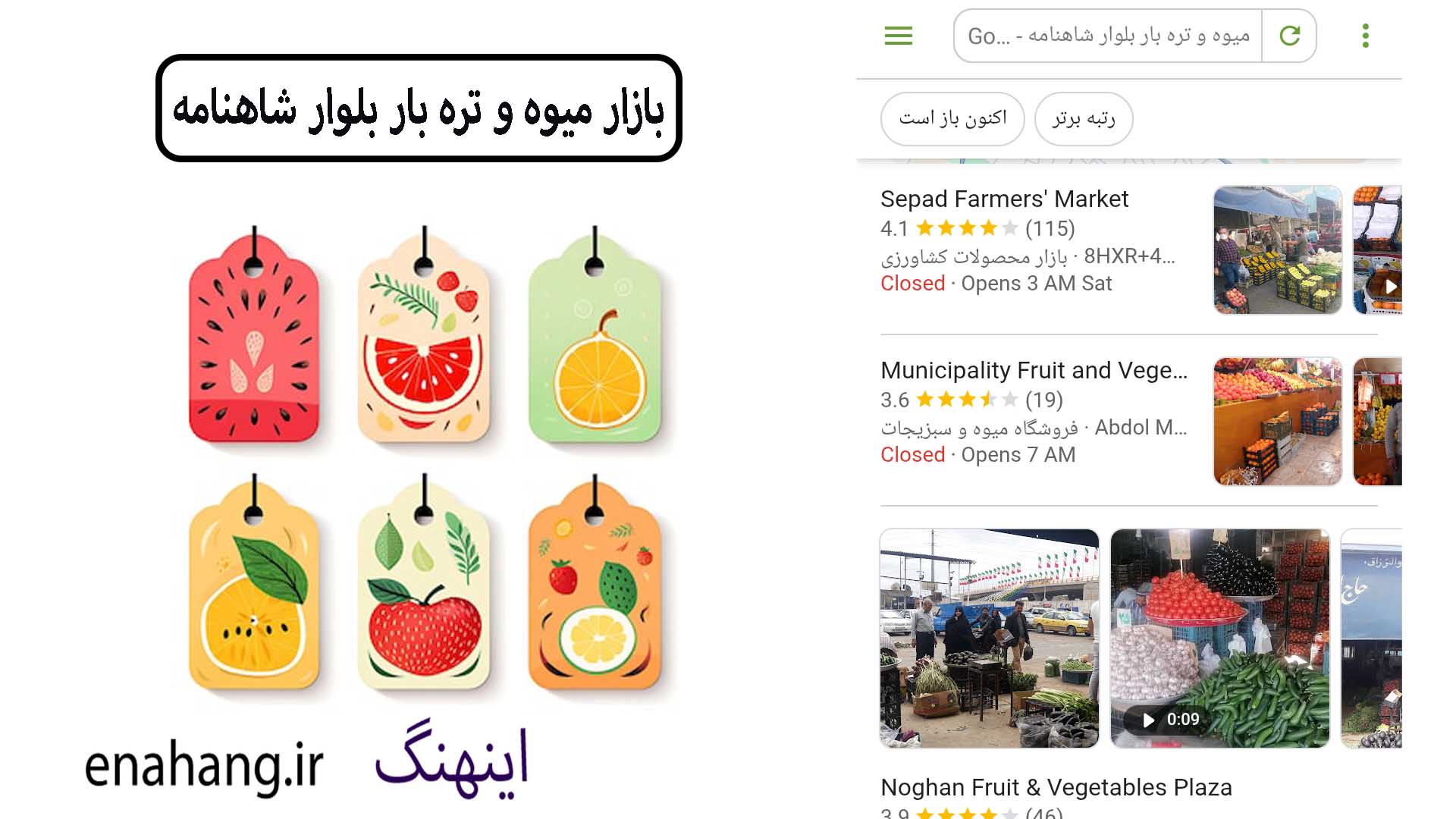
ویدئو بازار میوه تره بار بلوار شاهنامه را از اینجا میتوانید دانلود کنید.
آثاری از دیوار تابران توس در کناره کشفرود، جایی که پل فردوسی در آن قرار دارد مشاهده میشود. دیوار تاریخی توس که به نام حصار کهن دژ تابران توس نیز شناخته میشود، بقایای دیوار شهر باستانی توس است. این دیوار در دورههای مختلف تاریخی، از جمله ساسانیان و بعد از آن در دوره سلجوقیان مرمت شده است.
بخشی از این دیوار ستونی آجری است که نگاهی به آن بیندازیم: ستون آجری ساده بدون گچ کاری که تزئین کنار رودخانه را تا کنون در بر داشته است.
پل فردوسی در مسیر پیشرفت
خود پل فردوسی قدمت تاریخی بالایی دارد. آن را حدود ۵۰ سال پیش به صورت بتنی بازسازی کردند که بین دیواره های آجری باستانی کشفرود قرار میگیرد. پس از آن، در دهه نود شمسی مسابقه ای معماری برای بهبود ساختاری پل فردوسی و بوم پارک کشفرود در آن نزدیکی برگزار کردند که بین دانشجویان دانشگاه های سراسر کشور برگزار شد و جوایزی نیز اهدا شده است.
امروز در مسیر این بخش از رودخانه لوله گذاری های بزرگی شده است که پساب از پرکندآباد تا پل فردوسی را برای آبیاری فضای سبز بوم پارک کنار پل و منطقه شامل چهاربرج و کلاته برفی برعهده میگیرد. این مناطق شامل آثار باستانی و طبیعی حساسی هستند که دژ و داستان شاهنامه فردوسی از آن ها ریشه گرفته است و امروزه شامل موزه های طبیعی و به روزی در منطقه محسوب میشوند. بنای هارونیه با فاصله کمی از موزه آرامگاه فردوسی و پارک ژوراسیک قرار گرفته است که با چندین ایستگاه اتوبوس که در آن نزدیکی است، در دسترس هستند.
بوم پارک کشفرود
بخش سبز منطقه را برای تنفس برعهده میگیرد و مکانیابی آن کنار همین پل فردوسی در نظر گرفته شده است. بوم پارک را بویژه برای راحتی پرندگان بومی منطقه و پرندگان مهاجر عبوری طراحی کردهاند ، طوری که اردک ها بتوانند از آب آن استفاده کنند. کشفرود سالانه پذیرای پرندگان متنوعی از نقاط مختلف جهان است که پل فردوسی و جاذبه های طبیعی اطراف آن را از ظرفیت گردشگری بالایی برخوردار کرده است.
آدرس پل فردوسی کشفرود: مشهد، شهر توس، بلوار شاهنامه، میدان سپهبد
فاصله آرامگاه فردوسی تا بنای هارونیه
بنای هارونیه نسبت به آرامگاه فردوسی جای نزدیکتری به کشفرود قرار دارد. فاصله این بنا تا آرامگاه فردوسی چیزی حدود پانصد متر است.
مسیر از حرم مطهر رضوی: مشهد، مترو حرم رضوی، ایستگاه بسیج مترو، ایستگاه پارک ملت مترو پیاده میشوید.
در ادامه مسیر از پایانه اتوبوسرانی میدان آزادی، ایستگاه اتوبوس خط 202.1 سوار میشوید و ایستگاه پایانه فردوسی بلوار شاهنامه پیاده میشوید. از سمت پارک خطی آرامگاه فردوسی به سمت بنای هارونیه مسیری 500 متری که بروید کلی المان و جاهای دیدنی برای عکاسی هست که تا جای خود پل فردوسی کشفرود و دیوار تابران توس هستند.
________________________
"All the borders were barren and unpaved. Hemi went victorious to Kase Rud. At that border, the army landed. The ground was covered with tents and disappeared. It was reported that the Iranian army had left the country. Andar set out towards Kase Rud."
"Firdausi"
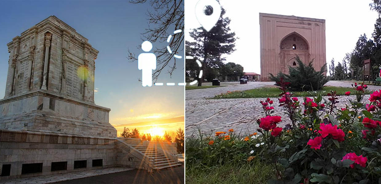
Ferdausi's Mausoleum in Mashhad
The Chahar Borj neighborhood is located a short distance from Almas Shargh, which is located near Khin Arab. Both are located on the route to Kashrud. Almas Shargh is considered modern and up-to-date in terms of construction, and the Chahar Borj neighborhood is a historical part of Mashhad.
Chahar Borj neighborhood, a place to live
The Chahar Borj neighborhood was once known as the village of Chahar Borj in the ancient city of Toos. Since ancient times, its dried berries next to Qaisy, when Kashrud was known on the Silk Road, have been world famous.
Niloufar Pond, Ferdowsi's Mausoleum in Mashhad
The 360-hectare area of Toos has been registered on the list of national monuments of Iran. Ferdowsi Tomb Museum consists of four parts including pottery pieces from the Islamic period and before, gold and silver coins from the Islamic period, and discovered artifacts from the ancient city of Toos.
Ferdowsi Museum - Ancient City of Toos
The ancient monuments of this area, especially the ancient citadel, are still standing after several hundred years. Large villages have gathered next to this area, whose gardens are of great importance next to Kashfrud. A market has formed next to this area where garden and rural products are sold. In the surrounding villages, they are active in the production of industries related to grapefruit, tangerine (orange peel, tangerine peel), oil, orange peel, apple puree, kiwi puree, peach puree, and tomato paste in bulk, which can be seen especially in the fruit and vegetable market from the direction of Ferdowsi Tomb.
Search for Fruit and Vegetable Market
You can download the video of the Fruit and Vegetable Market on Shahnameh Boulevard from here.
Traces of the Tabran Toos Wall can be seen on the banks of the Kashfrud, where the Ferdowsi Bridge is located. The historic Toos Wall, also known as the Old Fence of the Tabran Toos Fortress, is the remains of the ancient city wall of Toos. The wall has been restored in various historical periods, including the Sassanids and later the Seljuks.
Part of this wall is a brick column that we will take a look at: a simple brick column without plasterwork that has adorned the riverside to this day.
Ferdowsi Bridge on the Path of Progress
The Ferdowsi Bridge itself has a long history. It was rebuilt in concrete about 50 years ago and is located between the ancient brick walls of the Kashfrud. After that, in the 1990s, an architectural competition was held to improve the structure of the Ferdowsi Bridge and the nearby Kashfrud Ecopark, which was held among university students from all over the country, and prizes were also awarded.
Today, large pipes have been laid along this part of the river, which diverts the wastewater from Parkandabad to the Ferdowsi Bridge to irrigate the green space of the Bom Park near the bridge and the area including Chaharborj and Kalateh Barfi. These areas contain sensitive ancient and natural monuments from which the fortress and the story of Ferdowsi's Shahnameh originated, and today they are considered natural and up-to-date museums in the region. The Harunieh building is located a short distance from the Ferdowsi Mausoleum Museum and the Jurassic Park, which are accessible from several nearby bus stops.
The Bom Park of Kashfrud
takes over the green part of the region for breathing, and its location is considered next to the Ferdowsi Bridge. The Bom Park has been specially designed for the comfort of the native birds of the region and migratory birds passing through, so that ducks can use its water. Kashfrud annually welcomes a variety of birds from different parts of the world, which has given Ferdowsi Bridge and its surrounding natural attractions a high tourism potential.
Sights of Ferdowsi Bridge Kashfrud
Address of Ferdowsi Bridge Kashfrud: Mashhad, Toos City, Shahnameh Boulevard, Sepahbod Square
Distance between Ferdowsi Tomb and Harunieh Monument
Harunieh Monument is located closer to Kashfrud than Ferdowsi Tomb. The distance between this monument and Ferdowsi Tomb is about five hundred meters.
Directions from the Razavi Holy Shrine: Mashhad, Razavi Haram Metro, Basij Metro Station, Park Mellat Metro Station.
Further along the route, from Azadi Square Bus Terminal, take bus line 202.1 and get off at Ferdowsi Terminal Station on Shahnameh Boulevard. From the Ferdowsi Tomb Linear Park towards Harunieh Monument, there are many landmarks and places to take photos, including Ferdowsi Bridge Kashfrud and the Tous Tabran Wall.
کشفرود و قله هزار مسجد
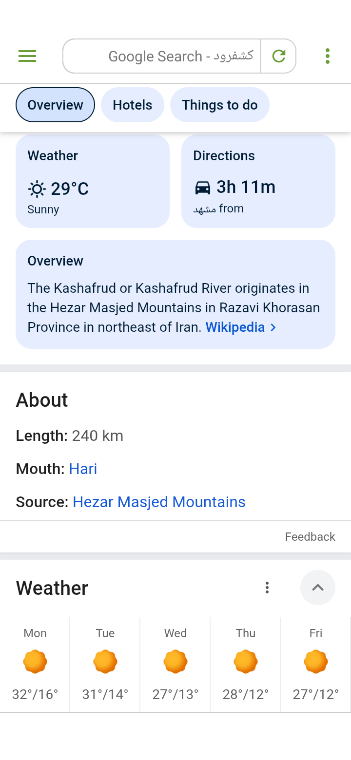
امروز که این مطالب رو مینویسم، چند روزه که بخاری ها رو خاموش کرده ایم. هوا رو به بیشتر بیابانی شدن و آلوده تر شدن میره. من در گوگل جستجو میزنم: "کشفرود" و خروجی برای دمای هوای یک هفته اینطور میشه:
دوشنبه: 16-32، سه شنبه 14-31، چهارشنبه 13-27، پنج شنبه 12-28، جمعه 12-27
یعنی هفته ای با هوای کاملا بیابانی را پیش رو داریم و حالا حالاها گرما و آلودگی بر کشفرود و شهر مشهد حاکم است.
دیگر آن زمان گذشت که میگفتن پوشش گیاهی منطقه با سوزاندن درختان زرشک و زالزالک برای هیزم نابود شده، الآن هنگام برداشت آلودگی از آب و هواست.
جزئیات دیگر عکس شامل جهت دهی ها به سمت کشفرود هست که میگه سه ساعت رانندگی با ماشین در این مسیر دارند و سرچشمه کشفرود کوه های هزار مسجد است.
قله هزار مسجد در شمال مشهد قرار گرفته و محل ییلاق هزاران دام عشایر خراسانی است. عشایری مانند بروانلو، صوفیانلو، باچوانلو، قره باشلو و سایرین با اعتقادی که به قله هزار مسجد دارند، هر ساله با نذر و نیازی که دارند به ارتفاع هزارمسجد میروند.
به روایتی، جنگی که بین مسلمانان و کفار در میدان هزار مسجد (النگ هزار مسجد) صورت گرفته است که در قسمت شرق قله قرار گرفته و اثرات پادگان و محل رزم آن مشخص است، و گاهی یک یا دو تیر پیکان زنگ زده به دست می آید. چون در این جنگ هزار نفر مسلمان شرکت داشته اند به نام هزار مسجد نامیده شده است.
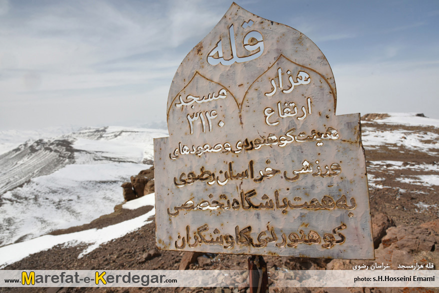
وضعیت قله هزار مسجد: فاصله از مشهد، 12 کیلومتر، ارتفاع 3040 متر
توپوگرافی: کوهستانی-صخره ای -تپه ماهور
دره سیستان در رشته کوه هزار مسجد شهرت جهانی داشته و منطقه شکار حفاظت شده است. پوشش گیاهی آن: جنگل های پوشیده اورس، زرشک، ارغوان، پسته کوهی، کلاه میرحسن، درمنه (گندواش)، گون، گیوچر، انجیر، زالزالک، بادام وحشی و انواع گیاهان دارویی شامل: آویشن، گل پپو، چای شکارچیان، آنخ، باریجه، اسطخودوس است که کل ها خیلی به آن علاقه مند هستند.
تنوع جانوری آن نیز شامل کل و بز کوهی، قوچ میش، پلنگ، کفتار، روباه، شغال، گرگ، گراز و تشی، کبک، تیهو، شاهین، کرکس، بالابان، همای، عقاب طلایی، سهره، دلیجه، سارکبه، سار، کور کور قرقی، چکاوک و باقرقره است.
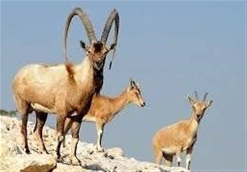
کل و بز گونه ای از بز کوهی است. نرها که کل نامیده میشوند شاخ های بلند وشمشیر مانندی دارند که هر گره از آن سن کل را نشان میدهد.
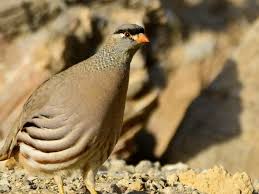
تیهو کوچکتر از کبک است. رنگ پرهای آن بیشتر تمایل به خاکستری دارد. در حالی که کبک ها پرهای روشن تر و با خال های بیشتری دارند. در زیر تصویر یک کبک را میبینید:
مطالب برگرفته از کتاب حیات وحش خراسان است که تاکنون چندین بار تجدید چاپ شده است.
__________________
As I write this, we have been turning off the heaters for a few days now. The weather is becoming more desert-like and polluted. I search Google for "Kashfrud" and the output for the weather temperature for a week is as follows:
Monday: 16-32, Tuesday 14-31, Wednesday 13-27, Thursday 12-28, Friday 12-27
That means we have a week of completely desert-like weather ahead of us, and now the heat and pollution are dominating Kashafrud and the city of Mashhad.
The time has passed when they said that the vegetation of the region was destroyed by burning barberry and hawthorn trees for firewood, now it is time to remove the pollution from the air and the climate.
Kashfrud weather
Other details of the photo include directions to Kashaf rood, which says that it is a three-hour drive by car on this route, and that the source of Kashfrud is the Hezar Masjid Mountains.
The peak of a thousand mosques is located in the north of Mashhad and is the summer home of thousands of cattle of Khorasani tribes. Tribes such as Barwanloo, Sufyanloo, Bachwanloo, Qara Bashloo and others, believing in the peak of a thousand mosques, go to the height of a thousand mosques every year with their vows and needs.
According to a legend, a war between Muslims and infidels took place in the field of a thousand mosques (alang a thousand mosques), which is located in the eastern part of the peak and the effects of the garrison and the battlefield are clear, and sometimes one or two rusty arrows are found. Because a thousand Muslims participated in this war, it was called a thousand mosques.
The peak of a thousand mosques - 3140 meters
The situation of the peak of a thousand mosques: Distance from Mashhad, 12 km, altitude 3040 meters
Topography: mountainous-rocky - Mahur hill
The Sistan Valley in the mountain range of a thousand mosques is world famous and is a protected hunting area. Its vegetation: forests of Urs, barberry, purple, mountain pistachio, Mirhasan hat, Artemisia (Gandavash), Goon, Guicher, fig, hawthorn, wild almond and various medicinal plants including: thyme, pepo flower, hunters' tea, ankh, barijeh, and lavender, which the kals are very interested in.
Its animal diversity also includes the kal and the antelope (Capra aegagrus), ram, leopard, hyena, fox, jackal, wolf, wild boar and tshi, partridge, hawk, falcon, vulture, balaban, homay, golden eagle, sparrowhawk, falcon, starling, kor kor qarqi, chakavak and grouse.
Difference between kal and antelope
The kal and the goat are a species of antelope. The males, which are called kal, have long, sword-like horns, each node of which indicates the age of the kal.
The kal is smaller than the kal. Its plumage tends to be more gray. While partridges have lighter feathers with more spots. Below is a picture of a partridge:
Partridge bird in the mountains of Hezar Masjid
The material is taken from the book Wildlife of Khorasan, which has been reprinted several times.