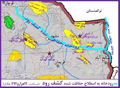
Kashafrud river - رودخانه کشف رود
اینجا درباره رودخانه کشفرود ایران مینویسمKashafrud river - رودخانه کشف رود
اینجا درباره رودخانه کشفرود ایران مینویسمدرباره من
 از اونهام که می گم آدم بایست حرف خودشو بزنه، اما یاد گرفتم که هر حرفی رو تو جاش بزنم، اینجا، هرچی می خوام رو می گم
ادامه...
از اونهام که می گم آدم بایست حرف خودشو بزنه، اما یاد گرفتم که هر حرفی رو تو جاش بزنم، اینجا، هرچی می خوام رو می گم
ادامه...
چکاوک کشفرود آرامگاه فردوسی
شنیدم تیم اصفهان تیم قناری بود. برام مهم نبود که چطور اینقدر برای تبلیغ قناریشون می جنگن.
مدتی گذشت و کشف رود از دست رفت.
رفتیم ببینیم چکاوکهایشان که در زاینده رود است را چطور تبلیغ می کنند. نگاه کردم و حتی اسم شرکتشان را چکاوک گذاشتند، چکاوک زاینده رود.
چکاوک رودخانه کشفرود کجاست؟
فکر می کنید نام شرکتشان را چکاوک چه سالی گذاشتند؟
با توجه به اینکه رودخانه کشفرود از محل آرامگاه فردوسی سرازیر می شه، باشگاه فردوسی لوگوی خود را به نام آرم آرامگاه فردوسی نامگذاری کرده. لباس مجلسی قناریه.
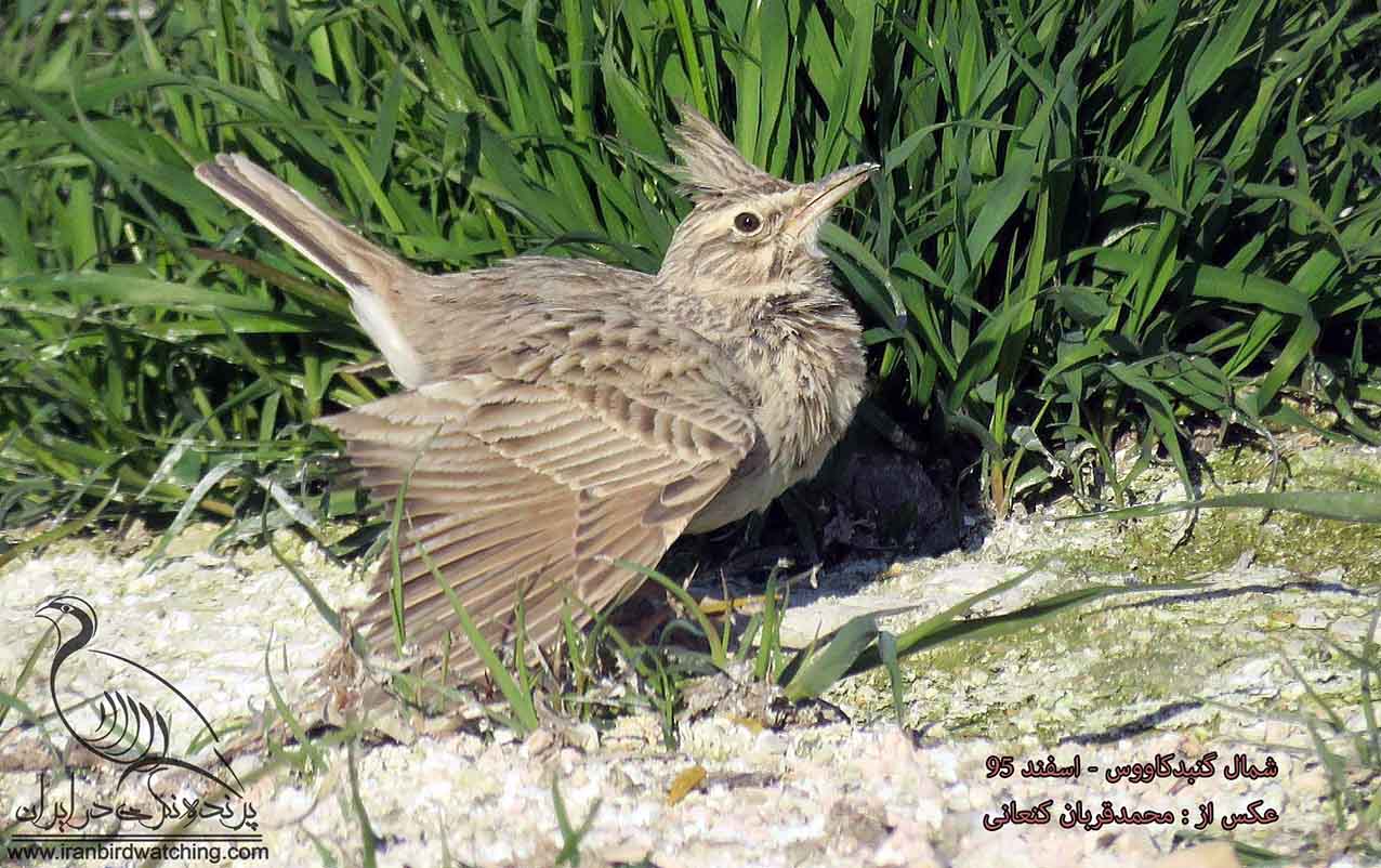
چکاوک از راسته گنجشکسانانه و در طبیعت های مختلف شکل های متفاوتی میگیره. انواع چکاوک بیابانی، گندم زار و غیره داریم
_________________
I heard that the Isfahan team was a canary team. I didn't care how they were fighting so hard to promote their canary.
A while passed and Kashfarud fell out of favor.
We went to see how they were promoting their sky lark, which is the Zayandeh River. I looked and they even named their company sky lark; Chakavak (sky lark) of Zayandeh Rood.
Where is the sky lark of Kashfarud river?
What year do you think they named their company Chakavak?
Considering that a Kashfarud River flows from the site of Ferdowsi's tomb, Ferdowsi Club has named its logo after the logo of Ferdowsi's tomb. The party dress is a canary.
The sky lark is from the order Passeriformes and takes on different forms in different natures. We have desert sky larks, wheat field skylarks, etc.
پل فردوسی شاهنامه -رودخانه کشف
پل فردوسی شاهنامه بر روی رودخانه کشفرود و نزدیک دروازه باستانی تابران قرار دارد. این دروازه از دیرباز به سبب مجاورت با کشفرود رودبار خوانده میشود. فردوسی «کشف رود» را در داستان کیخسرو و فرود و لشکرکشی طوس بن نوذر به مرز توران «کاسه رود» مینامد. تمدن تاریخی در گذشته در کنار این رودخانه شکل گرفته بود.
_dk88.jpg)
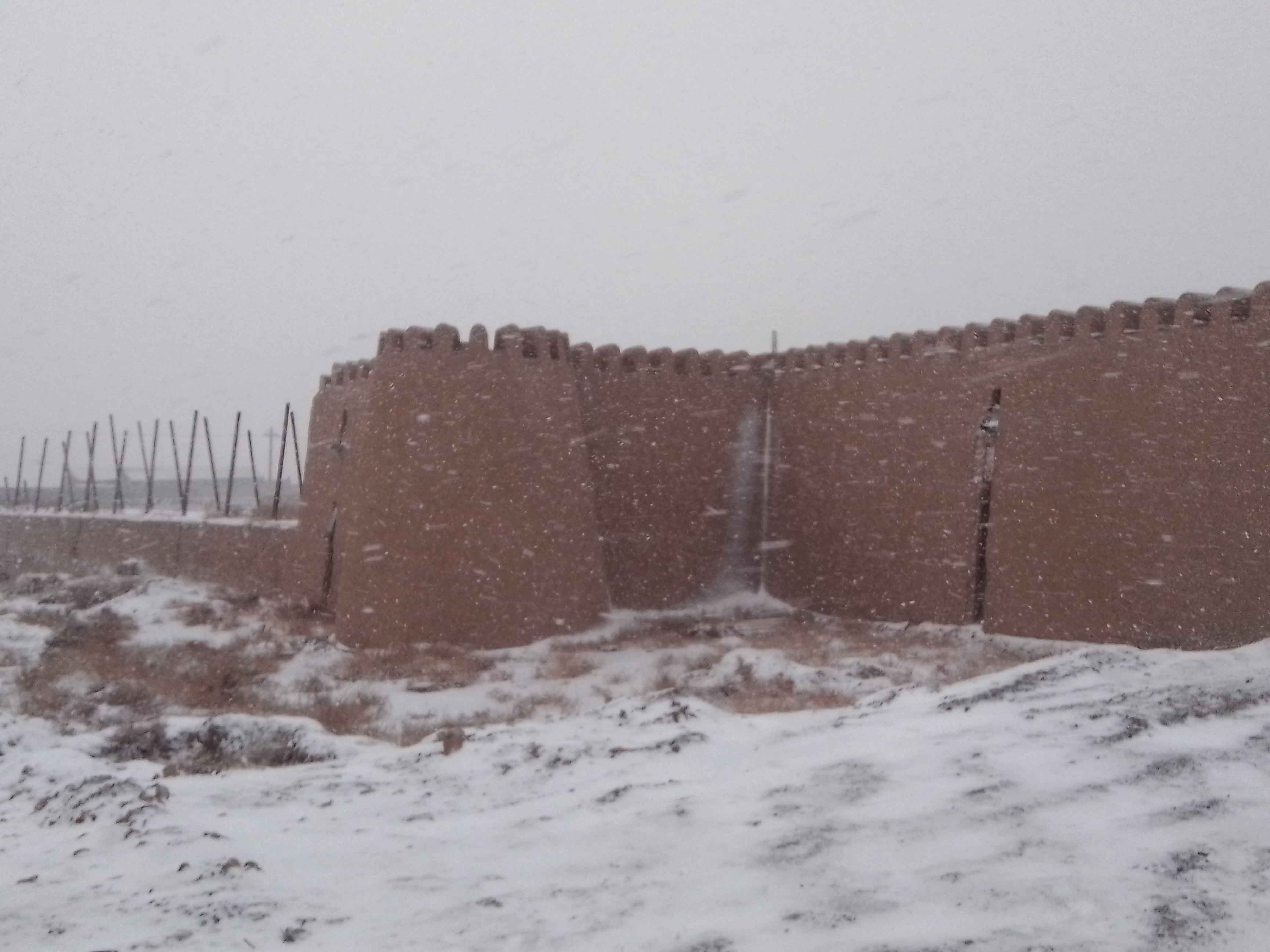
دیوارهای تاریخی تابران از محل همین پل و در امتداد رودخانه اساطیری کشفرود (کاسه رودخانه) آغاز می شود و امروز بقایای آجری آن را میبینید.
آن بخش از دیوار که همچون دژی مستحکم ساخته شده داستانی روایت گر دارد. از سمت دیوار که بالاتر و به سمت آرامگاه شاعر بزرگ و احیاگر فارسی (حکیم ابوالقاسم فردوسی) برویم هارونیه و سایر بقایای تاریخی را که در کنار رودخانه شکل گرفته بودند می بینیم. آثاری همچون آسیاب آبی روستای گوارشک از آن جمله است.
حکیم ابوالقاسم فردوسی دختری نیکسیرت داشت که پس از درگذشت پدر باقی بود و با اعمال نیکش در تاریخ ماندگار شد.
دختر فردوسی را باید در ردیف بانوان نیکاندیش و خیّری همچون گوهرشاد و پریزاد بانو بدانیم که آثار خیرخواهانهاش، هنوز در گوشه و کنار خطه هنرپرور خراسان باقی است و در این نوشتار، به برخی از آنها اشاره خواهیم کرد
مستنداتی وجود دارد که نشان میدهد، به احتمال زیاد، پایههای اولیه بند راهبردی گلستان که در تأمین آبادانی و کشاورزی شاهنامه، سهم انکارناپذیری دارد، توسط دختر فردوسی و با صرف بخشی از دستمزد سرایش شاهنامه گذاشته شد. این موضوعی است که میتوان در متون قدیمی، تاریخ شفاهی و پژوهشهای دوران اخیر، مانند مقاله مربوط به بندگلستان در «دایرةالمعارف آستانقدس رضوی»، ردپایی از آن یافت.
دیگر یادگاری دختر فردوسی، پلی بود که روی رودخانه کشفرود ساخته یا به قولی مرمت شد که برخی موقعیت آن را، در نزدیکی پلخاتون میدانند. این پل که امروزه اثری از آن در دسترس نیست، کاربرد فراوانی داشته و باعث کوتاهشدن مسیر مسافرانی میشده که از فرارودان، قصد مسافرت به ایران را داشتند.
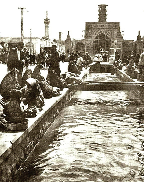
رودخانه کشفرود جاذبه گردشگریست که در مسیر آرامگاه فردوسی قرار دارد. در مسیر آن پلی قرار دارد به نام پل فردوسی که بزرگ و ساده است.
عکس پل فردوسی کشفرود:
_qmj9.jpg)
آدرس دقیق پل فردوسی:
خراسان رضوی، بلوار شاهنامه، میدان سپهبد، رودخانه کشفرود (کشف رود)
____________
Ferdowsi Shahnameh Bridge is located on the Kashfrud River and near the ancient Tabaran Gate. This gate has long been called Rudbar because of its proximity to Kashfrud. Ferdowsi calls "Kashfrud" "Kasehrud" in the story of Kaykhosro and the landing and expedition of Tus ibn Nozar to the border of Turan. Historical civilization was formed along this river in the past.
The historical walls of Tabaran begin from the site of this bridge and along the mythical river Kashfrud (Kasehrud), and today you can see its brick remains.
That part of the wall, which was built like a fortified fortress, has a narrating story. From the side of the wall, going higher and towards the tomb of the great poet and Persian revivalist (Hakim Abul-Qasim Ferdowsi), we see Haruniyeh and other historical remains that were formed along the river. Works such as the water mill of the village of Gidartak are among them.
Hakim Abul-Qasim Ferdowsi had a virtuous daughter who remained after her father passed away and remained in history with her good deeds.
We should consider Ferdowsi's daughter among the well-meaning and charitable women like Goharshad and Parizad Banu, whose charitable works still remain in every corner of the artistic region of Khorasan, and in this article, we will mention some of them.
There is evidence that shows that, most likely, the initial foundations of the strategic Golestan dam, which has an undeniable contribution to ensuring the prosperity and agriculture of Shahnameh, were laid by Ferdowsi's daughter, spending part of the salary of the composer of Shahnameh. This is an issue that can be traced in ancient texts, oral history, and recent research, such as the article on the Golestan dam in the "Encyclopedia of Astan Quds Razavi".
Another relic of Ferdowsi's daughter was a bridge that was built or, as some say, restored over the Kashf-Rud River, which some believe is located near Pol-e-Khatun. This bridge, of which no trace is available today, was widely used and shortened the route for travelers who wanted to travel to Iran via the river.
The Kashfrud River is a tourist attraction located on the way to Ferdowsi's tomb. On its way is a bridge called Ferdowsi Bridge, which is large and simple.
Photo of Ferdowsi Bridge, Kashfrud:
Exact address of Ferdowsi Bridge:
Khorasan Razavi, Shahnameh Boulevard, Sepahbod Square, Kashfrud River (Kashfrud)
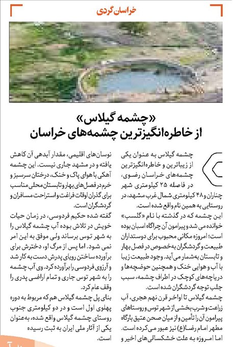
رودخانه کشفرود و گردشگری
به سن پدربزرگها، سیل آمد و افتاد توی سیلگیر که کال قرهخان بود و امتدادش به خیابان رازی میرسید. درواقع سیل از ملکآباد و کشفرود می آمد
پدربزرگ های ما اولین بازی غیر از خزینه را با آن سیل تجربه کردند.
کمی دنبال کال خیابان رازی که جستجو کنی باید نتیجه بگیری که از رودخانه کشفرود میومده تا زهکشی کنه.
نگاه میکنی رئیس شرکتی گردشگری داستان همون سالی که سیل اومده رو تعریف میکنه، نام چشمه گیلاس، آرامگاه فردوسی و چند جای دیگه رو میاره و عجیب کشفرود رو نمی آره.
نگاه میکنی بلوار دندانپزشکان و فرهنگیان و غیره از مسیر دانشگاه آزاد و بعد دانشگاه فردوسی رو طوری با رودخانه پارک و دریاچه مصنوعی پر کرده که انگار هیچوقت بی آبادانی نمیشه. زمین های دندان پزشکان اگر شاهنامه فردوسی هم بود همینطور در موردشانه؟
آیا این اتفاقیه؟
وقتی روستای کشفرود به شهرک شهید سلیمانی تغییر نام میده،
وقتی کشفرود حفاظت نمیشه کسی اونو نمیخواد.
روستای چشمه گیلاس با کل گیلاس هایش خشک میشه. مگر چقدر جمعیتشه؟
کل بلوار شاهنامه فردوسی با زمین هایش مگر چقدر جمعیتشه؟
آرمیتاژ و هتل دیگه در مسیر سرچشمه مایان کشفروده و با دریاچه مصنوعی خشک نمیشه. اونوقت میگن به کشاورزی آبرسانی کردیم. کدوم آبرسانی؟
داریم میبینیم سرچشمه بالادست رودخانه گرفتین. حقابه شاهنامه رو باید بدین.
اون شرکتی که جمعیت یکباری بر آبادانیش حکمفرمایی میکنه، شرکت فاضلابه.
جستجو کردن درباره وضعیت کنونی رودخانه کمی جسارت میخواهد. مهندسی خاک و یا کشاورزی نبودم، ولی بقدری رودخانه های کشفرود و اترک مشکل دارند که نوشتههایم ضروریه.
کمی علمی بگیم:
اجرای کال جمع آوری آبهای سطحی این است که این مسیر از زیر بزرگراه پیامبر عبور میکند. به این دلیل که با وجود ترافیک امکان مسدود کردن این بزرگراه نبوده ، اجرای این پروژه از روش لوله رانی میسر میشه.
از مشکلات این مسیل: وجود معارضاتی مانند تاسیسات و فیبر نوری اجرای یک پروژه را مشکل کرده. این مسیل به زودی به پایان می رسد.
_____________________
When our grandparents were young, a flood came and fell into the floodplain that was Qara Khan's village and extended to Razi Street. In fact, the flood came from Malekabad and Kashfrud
Our grandparents experienced the first game with that flood other than Khazineh.
If you search a little for the village of Razi Street, you should conclude that it came from the Kashafrud River to drain it.
You look at the head of a tourism company telling the story of the same year that the flood came, mentioning the names of the Cherry Spring, Ferdowsi's tomb, and a few other places, but strangely not mentioning Kashfrud.
You look at the dentists' and educators' boulevards, etc., from the Azad University route and then Ferdowsi University, filled with a park river and an artificial lake as if it would never be developed. If Ferdowsi's Shahnameh were there, would the dentists' lands be the same?
Is this a coincidence?
When the village of Kashafrud is renamed to Shahid Soleimani Town
When Kashfrud is not protected, no one wants it.
The village of Cheshme Gilas with all its cherries is drying up. How many people are there?
How many people are there on Shahnameh Ferdowsi Boulevard with its lands?
The Armitage and other hotels on the route of the Mayan Kashafrud source will not dry up with an artificial lake. Then they will say that we have supplied water to agriculture. Which water supply?
We are seeing that you have taken the upstream source of the river.
The company whose development is once dominated by the population is the sewage company.
It takes a little courage to research the current state of the river. I was not a soil engineer or an agricultural engineer, but the Kashafrud and Atrak rivers are so problematic that my writings are necessary.
Let's be a little scientific:
The implementation of surface water collection is due to the fact that this route passes under the Prophet's Highway. Because it is not possible to block this highway due to traffic, the implementation of this project is possible using the pipe method.
Among the problems with this issue: The existence of obstacles such as facilities and fiber optics has made it difficult to implement a project. This problem will end soon.
رودخانه کشف و نه کال کشف
بچه که بودیم خیابان رازی یک جایی پشت مغازهها و واحدهای مسکونی داشت که بهش میگفتن کال.
ما میدونستیم که اونجا نباید بریم، یه جایی بود گود بود.
پشتشم مغازههایی که بود مثلاً آپاراتی و جوشکاری و اینجور مغازهها که دکوراسیون خاصی لازم نداشتن.
این خیابان رازی که میگم دقیقاً وسط شهره یعنی اون طرفش میشه بیمارستان و این طرفش میشه خیابون چمران و دانشگاه. یعنی یک جای باصفایی که فضای سرسبز وسیعی در بیمارستان و در دانشگاه اطراف داره.
گذشت و میرفتیم و برمیگشتیم و کاری به اون کال نداشتیم
چند سال گذشت و دیدیم اونجا رو پوشوندن یک پارکی به اسم پارک چمران درست کردن و این پارک در فلان تاریخ تأسیس شد.
هر موقع از اونجا رد میشدیم یه وقت میدیدی که زیر پامون انگار یه فضای وسیعی به رودخونه فصلی اختصاص دادند. بعداً من نگاه کردم به کال میگن خشکرود. یعنی اینکه خشک خشک طغیان میکنه.
در خاطرات دور این کالی که اسمش الان خشکروده در واقعیت رودخانه خروشانی بوده. سرچشمه کجاست؟ بعضی وقتا هم سوپاپو اگه خواستن یه وقت باز کنن اونجا کالی هست.
گذشت و گذشت تا رسیدیم به خشکرودی کشفرود.
از ما اصرار که اینجا کلی پرندههای عجیب غریب میاد، اینجا آبادانی داره، اینجا باید جاری باشه، اینجا کانال آبرسانی نیست، از شهرداری و کارخانهها و هتلها و غیره انکار که اینجا خشکروده ما باید کالش کنیم.
نمونه مقاومت یک رودخانه برای اینکه کانال آبرسانی نشه رودخانه جاری زاینده. دسترسی به رسانه ملی داشتند و امکانات بیشتری در اختیار داشتند کشاورزیشون از کشاورزی ما قویتر بود و بالاخره تونستند هر چند یکبار آبش رو جاری کنند.
اما ما اینجا شاهد خشک شدن ماهی ها با رودخانه هستیم. یکمم که صدامون در میاد یه پروپاگاندایی تو رسانهها درست میکنند میگن براتون کار کردیم. میگردی تو اینترنت کلی حریم و بستر رودهای دیگه رو میبینی، ولی این در مورد کشفرود صادق نیست. انگار حریمی نداره، و همون خشکرود لیاقتشه!
همین که کار نمیکنند هم معنیش اینه که اینجا رودخانهای جاری نمیشه. تلاشهای ما بیخود
کلی عکس است از پلهای رودخانه که ما دقیقاً نمیدونیم از کدوم نقطه گرفتن.
فقط یک آرم خبرگزاری هست یک نام عکاس. تو کدوم نقشه ما این پل رو پیدا کنیم؟
این پلها که امروز نیستن، این پلها معلومه سالهاست گذاشتهاند.
زیادیمونه که این پلها همینطوریه
عکس نگاه کنید:
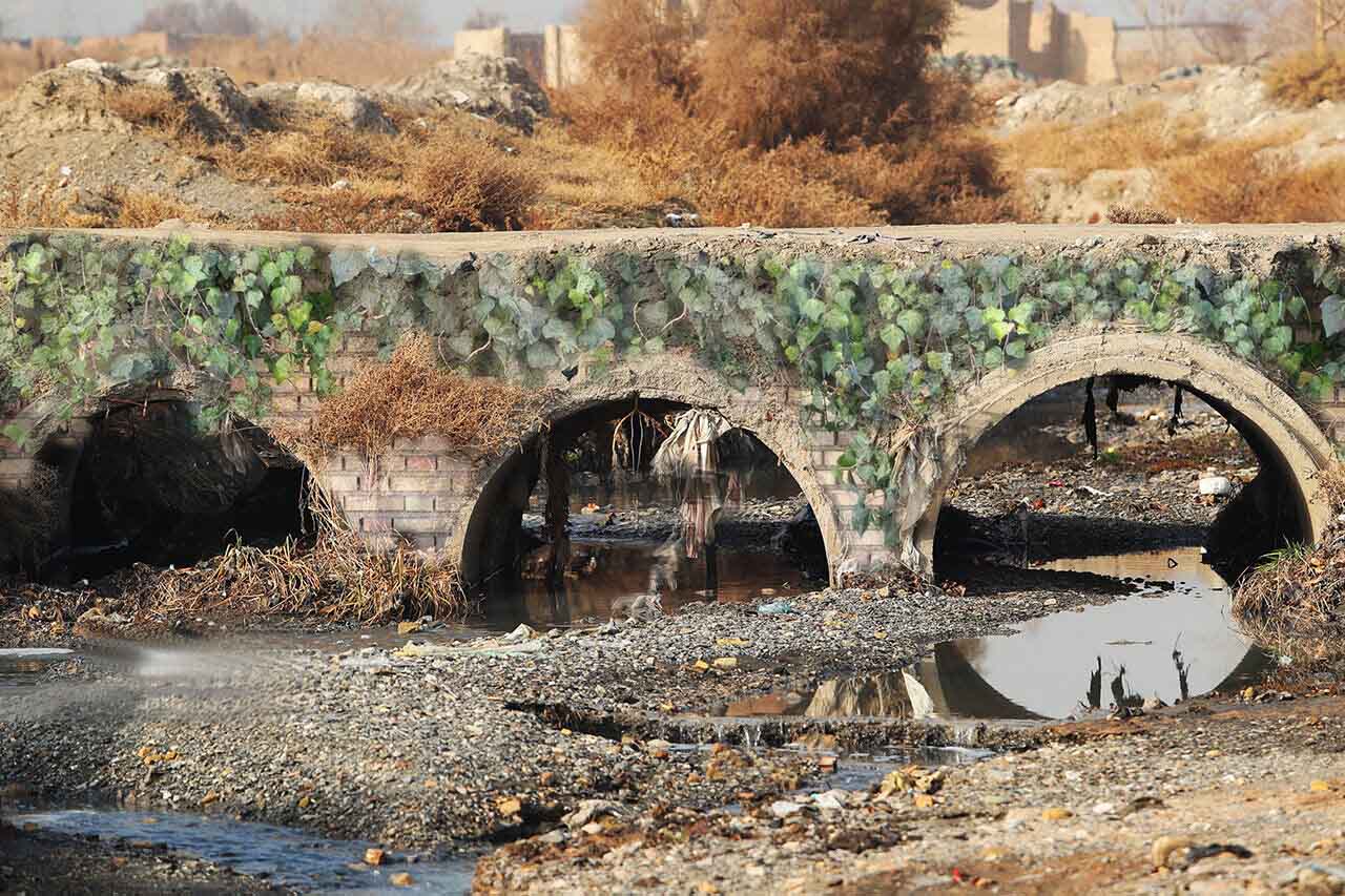
پیچک گذاشتم، وضعش خیلی از این خرابتره. میدونم این پل روی یکی از نقاط کشفروده. نمیدونم دقیقاً این کدوم یکی از پلهای بینام کشفروده.
جستجو میکنم پل فردوسی. خروجی میاد بهترین پل فردوسی که دیدین پل فردوسی زاینده روده.
اینم از پل فردوسی بلوار شاهنامه.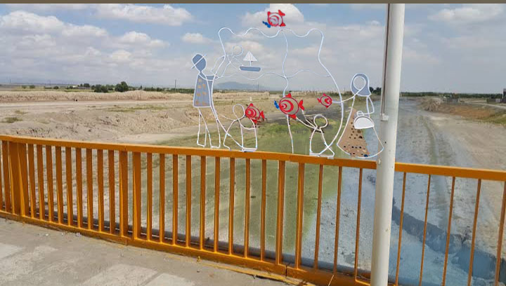
_____________________________
The Kashf River, Not the Kal Kashf River
When we were kids, there was a secret street behind the shops and residential units called Kal.
We knew we shouldn't go there, it was a place that was deep.
Behind me were shops like apparatus and welding shops and shops like that that didn't need any special decoration.
This secret street I'm talking about is right in the middle of the city, meaning that on the other side is the hospital and on the other side is Chamran Street and the university. That is, a clean place that has a large green space in the hospital and the university around it.
We passed by and went and came back and we had nothing to do with that Kal.
A few years passed and we saw that they were covering it up and creating a park called Chamran Park and this park was established on a certain date.
Every time we passed by there, you would see that under our feet, it seemed like they had allocated a large space for a seasonal river. Later, I looked at Kal, they call it Khoshkroud. It means that the dry river overflows.
In distant memories, this Kali, which is now called Khoshkrude, was actually a roaring river. Where is the source? Sometimes, even if they want to open a valve, there is Kali there.
We passed and passed until we reached Khoshkrude, the Kashfrude.
We insisted that all sorts of strange birds come here, that there is development here, that there should be water here, that there is no water supply channel, we denied that the municipality, factories, hotels, etc., that we should drain this Khoshkrude.
An example of a river's resistance to not becoming a water supply channel is the flowing river Zayandeh. They had access to the national media and had more facilities, their agriculture was stronger than agriculture, and finally they were able to make its water flow a few times.
But here we are witnessing the drying up of fish with the river. As soon as Saddam Hussein comes out, they make propaganda in the media, saying that we worked for you.
The fact that they are not working also means that there is no river flowing here. Our efforts are in vain.
There are a bunch of photos of river bridges that we don't know exactly from which point they were taken.
There is only an agency logo and a photographer's name. On which map can we find this bridge?
These bridges are not there today, these bridges have obviously been there for years.
There are many of us who think these bridges are like this
Look at the photo
I put an ivy, the condition is much worse than this. I know this bridge was discovered at one of the points. I don't know exactly which one of the nameless bridges was discovered.
I search for Ferdowsi Bridge. The exit is the best Ferdowsi Bridge you have ever seen, Ferdowsi Zayandeh Rud's Bridge.
This is from Ferdowsi Bridge on Shahnameh Boulevard.
مقایسه دروازه تاریخی خینعرب با دروازه کاشمری در دهلی نو
عکسها گویای وضعیت کنونی هستند:
هندوستان خواستگاه ادیان تاریخی، کاشمری های خراسانی را کنار رودخانه یامونا پذیرفته، ولی ایرانی ها تاریخ درستی از خینعرب ندارند.
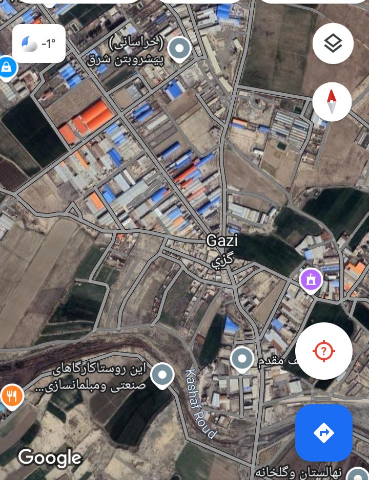
در نتیجه بی مهری خینعرب که زمانی روستایی پناه گرفته در کنار رودخانه باستانی کشفرود بوده است، اکنون پاتوق کارخانجات و کارگاه میشود. رودخانه کشفرود در تصویر دیده نمی شود، ولی رود یامونا بزرگ و وسیع جاریست.
رودخانه کشفرود با صنایع خشک میشود و ما نمیدانیم آن را سرچشمه خشکانده یا کارخانه.
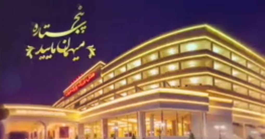
هتل در سرچشمه:
_________________
The photos are indicative of the current situation:
India, the birthplace of historical religions, has accepted the Kashmiris of Khorasani along the Yamuna River, but the Iranians do not have a correct history of Khin-e-Arab.
As a result of the lack of love, Khin-e-Arab, which was once a sheltered village along the ancient Kashfrud River, is now a hangout for factories and workshops. The Kashafrud River is not visible in the picture, but the Yamuna River is flowing large and wide.
The Kashfrud River is drying up with industries and we do not know whether it is the source that has dried it up or the factory.
Hotel in Sarcheshmeh: